Nakamachidai Station
Appearance
This article needs additional citations for verification. (November 2014) |
B28 Nakamachidai Station 仲町台駅 | |||||||||||
|---|---|---|---|---|---|---|---|---|---|---|---|
 Nakmachidai Station building | |||||||||||
| General information | |||||||||||
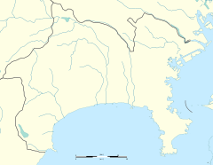
| Location | 1-1-1 Nakamachidai, Tsuzuki, Yokohama, Kanagawa (横浜市都筑区仲町台一丁目1-1) Japan | ||||||||||
| Operated by | Yokohama City Transportation Bureau | ||||||||||
| Line(s) | |||||||||||
| Platforms | 2 side platforms | ||||||||||
| Tracks | 2 | ||||||||||
| Other information | |||||||||||
| Station code | B28 | ||||||||||
| History | |||||||||||
| Opened | 18 March 1993 | ||||||||||
| Passengers | |||||||||||
| FY2008 | 14,321 daily | ||||||||||
| Services | |||||||||||
| |||||||||||
| |||||||||||
Nakamachidai Station (仲町台駅, Nakamachidai-eki) is a railway station on the Yokohama Subway Blue Line in Tsuzuki-ku, Yokohama, Kanagawa Prefecture, Japan, operated by Yokohama Municipal Subway.
Lines
[edit]Nakamachidai Station is served by the Blue Line, and is 34.1 km from the terminus of the Blue Line at Shōnandai Station.
Station layout
[edit]Nakamachidai Station has two opposed side platforms serving two tracks. The ground-level station building is located underneath the tracks and platforms.
Platforms
[edit]| 1 | ■ Blue Line | for Shin-Yokohama, Yokohama, Kannai, Totsuka, and Shōnandai |
| 2 | ■ Blue Line | for Azamino |
-
Ticket gates
-
Platform
History
[edit]Nakamachidai Station was opened on 18 March 1993. Platform edge doors were installed in April of 2007.[citation needed]
References
[edit]- Harris, Ken and Clarke, Jackie. Jane's World Railways 2008-2009. Jane's Information Group (2008). ISBN 0-7106-2861-7
External links
[edit]Wikimedia Commons has media related to Nakamachidai Station.
- Nakamachidai Station (Blue Line) (in Japanese)


