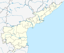
Nagarjuna Sagar Airport
Appearance
Nagarjuna Sagar Airport | |||||||||||
|---|---|---|---|---|---|---|---|---|---|---|---|
| Summary | |||||||||||
| Airport type | Public | ||||||||||
| Owner/Operator | Airport Authority of India[1] | ||||||||||
| Serves | Nagarjuna Sagar | ||||||||||
| Location | Nagarjuna Sagar, Andhra Pradesh | ||||||||||
| Time zone | Indian Standard Time (+5:30) | ||||||||||
| Elevation AMSL | 656 ft / 200 m | ||||||||||
| Coordinates | 16°32′33″N 079°19′07″E / 16.54250°N 79.31861°E | ||||||||||
| Map | |||||||||||
 | |||||||||||
| Runways | |||||||||||
| |||||||||||
Nagarjuna Sagar Airport is an airport located in Guntur District in the state of Andhra Pradesh, India.[3] The airport is used by private and chartered aircraft and has no scheduled services.[4] There are plans to upgrade the facility to enable scheduled commercial operations.[5][6] In March 2020, the Airports Authority of India announced it was considering developing the airport into a water aerodrome for use by seaplanes.[7][8][9]
References
[edit]- ^ "AAI page". aai.aero.
- ^ "Great Circle Mapper".
- ^ "Andhra may develop Nagarjuna Sagar Airport". The news minute. 20 April 2017.
- ^ "Flights from Nagarjuna Sagar soon". The Hans India. 16 April 2019.
- ^ Vasudevan, Patri (20 April 2017). "Nagarjunasagar may get a new airport". Deccan Chronicle.
- ^ "AAI appoints consultant to prepare detailed project report". The New Indian Express.
- ^ "Seaplane services to start at six places: Govt". The Economic Times. 7 February 2019.
- ^ "Nagarjunasagar may get water aerodrome facility | Hyderabad News - Times of India". The Times of India. 16 December 2018.
- ^ "Seaplane tourism project in Krishna river back on cards". The New Indian Express. 5 February 2020. Retrieved 1 February 2023.


