Naddle Forest
| Site of Special Scientific Interest | |
| Location | Cumbria |
|---|---|
| Grid reference | NY495145 |
| Coordinates | 54°31′30″N 2°46′48″W / 54.52500°N 2.78000°W |
| Area | 1,251.3 acres (5.1 km2; 2.0 sq mi) |
| Notification | 1986 |
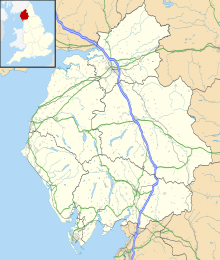
Naddle Forest is a Site of Special Scientific Interest (SSSI)[1][2] within the Lake District National Park in Cumbria, England. It is located on either side of the northern section of Haweswater reservoir, near the villages; Burnbanks and Bampton.
Naddle Forest SSSI includes Low Forest, Guerness Wood, High Forest and Mirkside. The protected area includes Wallow Crag.
Details
[edit]Naddle Forest SSSI is situated on steep slopes, comprises sections of semi-natural deciduous woodland with a continental composition of mosses and lichens. Red squirrels are found here. Non-wooded areas include areas dominated by juniper. Naddle Forest is noted for its lichen species, including Lobaria pulmonaria. Moss species include Ptilium crista-castrensis.[1]
Low Forest and Guerness Wood are dominated by sessile oak trees. Ferns here include Dryopteris filix-mas and Polystichum lonchitis. Plant species include sanicle (Sanicula europea) and the grass species wood fescue (Festuca altissima). Parts of the woodland are carpeted by bluebells.[1]
High Forest and Mirkside are dominated by ash and hazel. The plant species here include water avens and golden saxifrage.[1]
Land ownership
[edit]Most of the area designated as Naddle Forest SSSI is owned by United Utilities.[3]
References
[edit]- ^ a b c d "SSSI detail". designatedsites.naturalengland.org.uk. Retrieved 20 October 2024.
- ^ "Protected Planet | Naddle Forest". Protected Planet. Retrieved 31 December 2024.
- ^ "Mapping the habitats of England's ten largest institutional landowners". Who owns England?. 6 October 2020. Retrieved 20 October 2024.

