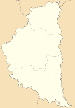
Myshkiv
Appearance
Myshkiv
Мишків | |
|---|---|
Village | |
 Seret River near the village | |
| Coordinates: 48°46′28″N 25°49′36″E / 48.77444°N 25.82667°E | |
| Country | |
| Oblast | Ternopil Oblast |
| Raion | Chortkiv Raion |
| Hromada | Bilche-Zolote rural hromada |
| Time zone | UTC+2 (EET) |
| • Summer (DST) | UTC+3 (EEST) |
| Postal code | 48605 |

Myshkiv (Ukrainian: Мишків) is a village in Bilche-Zolote rural hromada, Chortkiv Raion, Ternopil Oblast, Ukraine.[1]
History
[edit]The first written mention is from 1495.[2]
After the liquidation of the Borshchiv Raion on 19 July 2020, the village became part of the Chortkiv Raion.[3]
Religion
[edit]- Church of St. Demetrius (1784, brick, restored in 1927, OCU),[2]
- Roman Catholic Church (1910, not functioning since 1945),[2]
- Chapel of the Mother of God (2000).[2]
References
[edit]- ^ Більче-Золотецька територіальна громада, Децентралізація
- ^ a b c d (in Ukrainian) Безгубенко О., Олійник В., Уніят, В., Мишків // Ternopil region. History of cities and villages: in 3 v. / Ternopil: "Terno-graph", 2014, V. 2: Г—Л, S. 190—191. — ISBN 978-966-457-228-3.
- ^ Постанова Верховної Ради України від 17 липня 2020 року № 807-IX "Про утворення та ліквідацію районів"
Sources
[edit]- (in Ukrainian) Дубецький І., Олійник В., Сорока, М., Мишків // Ternopil Encyclopedic Dictionary: in 4 v. / editorial board: H. Yavorskyi and other, Ternopil: "Zbruch", 2005, V. 2: К—О, S. 524—525. — ISBN 966-528-199-2.
- "Myszków". Geographical Dictionary of the Kingdom of Poland (in Polish). p. 365.

