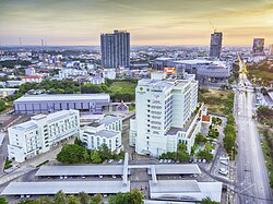
Mueang Khon Kaen district
Mueang Khon Kaen
เมืองขอนแก่น | |
|---|---|
 Aerial view of the district | |
| Motto(s): รักษาประเพณี พัฒนาท้องที่
สร้างสามัคคีในสังคม นิยมประหยัด Protect culture, Upgrade local, build Unity in Society, admire conserve. | |
 District location in Khon Kaen province | |
| Coordinates: 16°26′18″N 102°50′20″E / 16.43833°N 102.83889°E | |
| Country | Thailand |
| Province | Khon Kaen |
| Seat | Nai Mueang |
| Area | |
• Total | 953.4 km2 (368.1 sq mi) |
| Population (2022) | |
• Total | 412,758 |
| • Density | 432.93/km2 (1,121.3/sq mi) |
| Time zone | UTC+7 (ICT) |
| Postal code | 40000 |
| Geocode | 4001 |
Mueang Khon Kaen (Thai: เมืองขอนแก่น, pronounced [mɯ̄aŋ kʰɔ̌ːn kɛ̀n]; Northeastern Thai: เมืองขอนแก่น, pronounced [mɯ᷇aŋ kʰɔ̌ːn kɛ́n]) is the capital district (amphoe mueang) of Khon Kaen province, northeastern Thailand.
Geography
[edit]Neighboring districts are (from the south clockwise) Ban Haet, Phra Yuen, Ban Fang, Ubolratana, Nam Phong, and Sam Sung of Khon Kaen Province; Kosum Phisai and Chiang Yuen of Maha Sarakham province.
History
[edit]On 29 April 1917, the district name was changed from Mueang to Phra Lap (พระลับ).[1] On 14 November 1937 it was renamed Mueang Khon Kaen.[2]
Administration
[edit]The district is divided into 17 sub-districts (tambons), which are further subdivided into 272 villages (mubans). The city (thesaban nakhon) Khon Kaen covers the whole tambon Nai Mueang. Tha Phra is a sub-district municipality (thesaban tambon) covering parts of tambon Tha Phra. There are a further 16 tambon administrative organizations (TAO).
| No. | Name | Thai | Villages | Pop. (2008)[3] |
|---|---|---|---|---|
| 1. | Nai Muang | ในเมือง | - | 118,203 |
| 2. | Samran | สำราญ | 13 | 9,637 |
| 3. | Khok Si | โคกสี | 14 | 8,788 |
| 4. | Tha Phra | ท่าพระ | 20 | 19,197 |
| 5. | Ban Thum | บ้านทุ่ม | 17 | 17,088 |
| 6. | Mueang Kao | เมืองเก่า | 17 | 24,840 |
| 7. | Phra Lap | พระลับ | 19 | 20,803 |
| 8. | Sawathi | สาวะถี | 23 | 17,751 |
| 9. | Ban Wa | บ้านหว้า | 13 | 10,632 |
| 10. | Ban Kho | บ้านค้อ | 19 | 15,352 |
| 11. | Daeng Yai | แดงใหญ่ | 10 | 7,190 |
| 12. | Don Chang | ดอนช้าง | 8 | 4,745 |
| 13. | Don Han | ดอนหัน | 15 | 9,812 |
| 14. | Sila | ศิลา | 28 | 44,194 |
| 15. | Ban Pet | บ้านเป็ด | 23 | 29,801 |
| 16. | Nong Tum | หนองตูม | 11 | 7,375 |
| 17. | Bueng Niam | บึงเนียม | 12 | 7,291 |
| 18. | Non Thon | โนนท่อน | 10 | 9,457 |
References
[edit]- ^ "ประกาศเรื่องเปลียนชืออำเภอ" [Notice of changing district name] (PDF). Royal Thai Government Gazette. 34: 40–68. 29 April 1917. Archived from the original (PDF) on 7 November 2011. Retrieved 15 November 2019, page 60
{{cite journal}}: CS1 maint: postscript (link) - ^ "พระราชกฤษฎีกา เปลี่ยนนามจังหวัด และอำเภอบางแห่ง พุทธศักราช ๒๔๘๑" [Royal Decree: Change name of Provinces and Districts] (PDF). Royal Thai Government Gazette. 55: 658–666. 14 November 1938. Archived from the original (PDF) on 8 November 2011. Retrieved 20 April 2020, page 659
{{cite journal}}: CS1 maint: postscript (link) - ^ "Population statistics 2008". Department of Provincial Administration. Archived from the original on 4 June 2009. Retrieved 10 November 2009.
External links
[edit]- amphoe.com (Thai)
