Hwawangsan
Appearance
(Redirected from Mount Hwawang)
| Hwawangsan 화왕산 火旺山 | |
|---|---|
| Highest point | |
| Elevation | 757 m (2,484 ft) |
| Coordinates | 35°32′52″N 128°31′58″E / 35.54778°N 128.53278°E |
| Geography | |
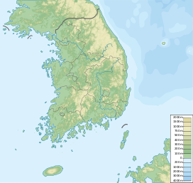
| Location | Gyeongsangnam-do, South Korea |
| Geology | |
| Mountain type | Arête |
| Climbing | |
| First ascent | not recorded |
| Easiest route | Hiking route 1 |
Hwawangsan (Korean: 화왕산; Hanja: 火旺山) or Hwawang, is a mountain in Changnyeong County of South Gyeongsang Province, southeastern South Korea. It has an elevation of 757 metres.[1]
Etymology
[edit]The name Hwawang is from Korean hwawang 'energetic fire', from hwa (Korean: 화; Hanja: 火), meaning "fire", and wang (Korean: 왕; Hanja: 旺), meaning "vigorous".
The name originated from the fire festival and practice of burning dry weeds and rice fields that took place every year on January 15.
Overview
[edit]It is one of the three primary tourist locations in Changnyeong County.[2] On January 11, 1984, it was designated as a national park.[3]


See also
[edit]References
[edit]- ^ An Gyeong-ho (2007). 한국 300 명산 (300 Korean Mountains). Seoul: 깊은솔 (Gipeunsol). ISBN 978-89-89917-21-2.
- ^ Changnyeong town website Archived 2008-10-23 at the Wayback Machine
- ^ "Korean Mountain Hiking news". Archived from the original on 2012-09-13. Retrieved 2013-10-01.


