Migovec System
| Migovec System | |
|---|---|
 | |
| Location | Tolmin, Slovenia |
| Coordinates | 46°15′07.1″N 13°45′50.4″E / 46.251972°N 13.764000°E |
| Depth | 972 m (3,189 ft) |
| Length | 45,329 m (148,717 ft) |
| Geology | limestone |
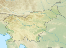
The Migovec System (Slovene: Sistem Migovec) is a 43,009-metre-long (141,000 ft) and 972-metre-deep (3,190 ft)[1] Alpine cave system within Mount Tolmin Migovec (Tolminski Migovec) in the Municipality of Tolmin in northwestern Slovenia.[2] The mountain and the cave system are part of Triglav National Park. The combined system is the longest known cave in the country, followed by the Postojna Cave System (24,340 m or 79,900 ft).[3][4]
Entrances
[edit]The entrances include:[5]
- Chough Cave (Kavkna Jama) (M2), first explored in 1972; the highest entrance to the system, at 1861 m above sea level
- M16, first explored in 1982
- Torn T-Shirt Cave (Jama Strgane Srajce) (M18), first explored in 1994[6]
- Gardeners' World (Vrtnarija), first explored in 2000
- Fairies' Cave (Vilinska Jama), first explored in 2008
- Primadona, first explored in 1999, collapsed in 2018
- Monatip, first explored in 2007
- Belladonna, first explored in 2018, after the collapse of Primadona
Exploration
[edit]The majority of exploration has been carried out by the Caving Section of the Tolmin Mountaineering Club (Jamarska Sekcija Planinskega društva Tolmin), joined since 1994 by Imperial College Caving Club.[5]
Chough Cave (M2), Torn T-Shirt (M18), and M16 were connected together in 1996[7] to form the initial Migovec System, which was then explored to an eventual depth of −970 m (−3,180 ft).[8] In 2008, exploration of Fairy Cave led to an almost immediate connection with Gardeners' World, and on 13 August 2012 Gardeners' World was connected to the Migovec System at a depth of −650 m (−2,130 ft).
Primadona and Monatip, two entrances located on the Western cliff of the Migovec plateau form a cave that was first explored in 1999. The cave had been explored to a length of 2.7km before being connected to the rest of the Migovec System at a depth of −180 m (−590 ft) in late 2015.
See also
[edit]References
[edit]- ^ Borivoj Ladišić. Prijavljeni jamarski dosežki v obdobju 2005–2014 (PDF) (in Slovenian). p. 59-62. Retrieved 15 May 2023.
- ^ "M-16 (Tolminski Migovec), Kataster jam, kat. št. 6001" [M-16 (Tolminski Migovec), Slovenian Cave Registry, Cave No. 6001] (in Slovenian). Društvo za raziskovanje jam Ljubljana [Ljubljana Cave Exploration Society]. Retrieved 8 January 2021.
- ^ "Postojnska jama, Kataster jam, kat. št. 747" [Postojna Cave, Slovenian Cave Registry, Cave No. 747] (in Slovenian). Društvo za raziskovanje jam Ljubljana [Ljubljana Cave Exploration Society]. Retrieved 8 January 2021.
- ^ Močnik, Blaž (16 August 2012). "Nov najdaljši jamski sistem je pod Migovcem" [The New Longest Cave System Is Under Migovec]. Delo.si (in Slovenian). Delo, d. d. ISSN 1854-6544.
- ^ a b Imperial College Caving Club / Jamarska Sekcija PD Tolmin, The Hollow Mountain. ICCC Journal No. 22, 2007
- ^ Imperial College Caving Club / Jamarska Sekcija PD Tolmin, The Hollow Mountain. ICCC Journal No. 22, 2007, p. 19
- ^ Caves & Caving, Issue 76, Summer '97, p. 20
- ^ Caves & Caving, Issue 80, Summer '98, p. 23
External links
[edit]- Map of Registered Cave Entrances on Tolmin Migovec. Geopedia.si


