Manyueyuan National Forest Recreation Area
Appearance
| Manyueyuan National Forest Recreation Area Chinese: 滿月圓國家森林遊樂區 | |
|---|---|
 | |
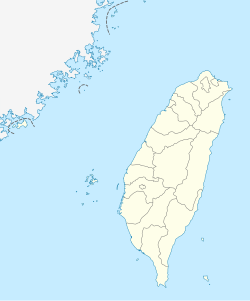
| Map | |
| Geography | |
| Location | Sanxia, New Taipei, Taiwan |
| Coordinates | 24°49′49.7″N 121°26′40.9″E / 24.830472°N 121.444694°E |
| Elevation | 300-1,700 meters |
| Area | 637 hectares |
Manyueyuan National Forest Recreation Area (traditional Chinese: 滿月圓國家森林遊樂區; simplified Chinese: 满月圆国家森林游乐区; pinyin: Mǎnyuèyuán Guójiā Sēnlín Yóulè Qū) is a forest located in Sanxia District, New Taipei, Taiwan.
Geology
[edit]The forest spans over an area of 637 hectares at an elevation of 300–1,700 meters with an annual mean temperature of 19.9°C.[1] The northern part of the forest shares a border with Mount Beichatian (Chinese: 北插天山).
Facilities
[edit]The forest consists of a walking trail connected to Dongyanshan Forest Recreation Area with a length of 1,727 meters. It has campsites at the base of Mount Beichatian.[2] The total length of the forest walking trail is 1,210 meters.[3]
Transportation
[edit]The forest is accessible by bus or taxi from Yingge Station of Taiwan Railways.[2]
See also
[edit]References
[edit]- ^ "Manyueyuan Forest Recreation Area". Forestry Bureau, Council of Agriculture, Executive Yuan. Retrieved 29 August 2019.
- ^ a b "Manyueyuan Forest Recreation Area". Lonely Planet. Retrieved 29 August 2019.
- ^ "Manyueyuan National Forest Recreation Area". Taiwan, the Heart of Asia. 19 April 2008. Retrieved 29 August 2019.
Wikimedia Commons has media related to Manyueyuan National Forest Recreation Area.

