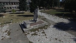
Malo Konare
You can help expand this article with text translated from the corresponding article in Bulgarian. (December 2008) Click [show] for important translation instructions.
|
Malo Konare
Мало Конаре | |
|---|---|
 | |
| Coordinates: 42°12′00″N 24°25′59″E / 42.200°N 24.433°E | |
| Country | |
| Oblast | Pazardzhik |
| Opština | Pazardzhik |
| Government | |
| • Mayor (Municipality) | Petar Kulenski (PP–DB) |
| • Mayor (Town Hall) | Dimcho Karaivanov |
| Area | |
• Total | 52.214 km2 (20.160 sq mi) |
| Elevation | 209 m (686 ft) |
| Population (2024) | |
• Total | 3,852 |
| • Density | 74/km2 (190/sq mi) |
| Area code | 03513 |
| Vehicle registration | РА |
Malo Konare (Bulgarian: Мало Конаре) is a village located in Pazardzhik Municipality, Pazardzhik Province, of southern Bulgaria. The population is 3,852 as of 2024 and is the biggest village in the municipality.[1]
Geography
[edit]Malo Konare is located in the eastern part of Pazardzhik Province and lies 8 km away from the municipal centre Pazardzhik and 106 km away from the capital Sofia.[2][3] It borders Luda Yana to the west and its territory in the northwest reaches the left bank of the river. Its width is 4 km to the north, south and east. Malo Konare is located in the Upper Thracian Plain with an elevation of 209 m and is on flat terrain with the exception of some Thracian mounds which break its flat monotomy. The biggest of them all is "Staro selishte" which is located 4 km east from the village.[4] The plain around the Luda Yana is slightly raised and uneven.[5] There are oak, acacia, poplar and zelkova trees. There are many orchards on the village's territory.[6] The land is fertile and is made up of alluvial and loess soils.[6][2]
Economy and infrastructure
[edit]
Agriculture is developed in Malo Konare. Many types of fruits and vegetables are grown. There are also vineyards and orchards.[2] Livestock breeding such as cattle, poultry and sheep is also developed.[2] There is also a fishery.[7]
Infrastructure is poorly developed. The water supply is made up of three class pumps. The water source is groundwater.[8] Since 2011 there are over 1900 homes.[9] The houses are mainly made of bricks, concrete slabs and metal joists.[10] The village is served by the first class I-8 road the starting point of the 37 km long third class III-8003 road.[11]
References
[edit]- ^ "Tables of Persons Registered by Permanent Address and by Current Address". Official Site of the Civil Registration and Administrative Services (GRAO). 15 March 2024. Retrieved 4 June 2024.
- ^ a b c d Great Encyclopedia Bulgaria 2011, p. 2690.
- ^ "Malo Konare". Guide Bulgaria. Retrieved 4 June 2024.
- ^ Pazardzhik Municipality 2011, p. 300.
- ^ Batakliev 1969, p. 432.
- ^ a b Batakliev 1969, p. 433.
- ^ Integrated Development Plan 2021-2027, p. 52.
- ^ Integrated Development Plan 2021-2027, p. 112.
- ^ Integrated Development Plan 2021-2027, p. 169.
- ^ Integrated Development Plan 2021-2027, pp. 167–168.
- ^ "A Map of the Republican Road Network of Bulgaria". Official Site of the Road Infrastructure Agency. Retrieved 4 June 2024.
Bibliography
[edit]- Great Encyclopedia Bulgaria (in Bulgarian) (7 ed.). Sofia: Trud. 2011. ISBN 978-9-54398-153-3.
- Pazardzhik Municipality (2011). Encyclopedia Pazardzhik (in Bulgarian). Pazardzhik: Belloprint. ISBN 978-954-684-308-1.
- Batakliev, Ivan (1969). Pazardzhik and Pazardzhishko (in Bulgarian). Sofia: Profizdat.
- Integrated Development Plan of Pazardzhik Municipality (PDF). Pazardzhik Municipality. 2021.

