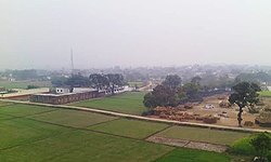
Kusi, Dildarnagar
Appearance
This article needs additional citations for verification. (January 2021) |
Kusi
Mustafabad | |
|---|---|
village | |
 Aerial view of the village Kusi, winter 2015 | |
| Nickname: Cleanest village of Ghazipur | |
| Coordinates: 25°24′33″N 83°38′05″E / 25.409167°N 83.634839°E | |
| Country | |
| State | Uttar Pradesh |
| District | Ghazipur |
| Established | 1610 |
| Founded by | Zamindar Azam Khan |
| Government | |
| • Body | Gram Panchayat |
| Area | |
• Total | 436.91 ha (1,079.63 acres) |
| • Land | 428.822 ha (1,059.642 acres) |
| • Water | 8.088 ha (19.986 acres) |
| Population (2011) | |
• Total | 5,710 |
| • Density | 1,300/km2 (3,400/sq mi) |
| Demonym | Kamsari |
| Local language Bhojpuri | |
| • Official | Hindi Urdu |
| Time zone | UTC+5:30 (IST) |
| Vehicle registration | UP |
| Website | up |
Kusi (previously known as Mustafabad) is a village of Kamsaar in Ghazipur district in the Indian state of Uttar Pradesh. The village has also Jama masjid Kusi.[clarification needed] The nearest railway station is Dildar nagar. As of 2011 census the main population of the village lived in an area of 62 acres and had 796 households. The family of Kusi were one of the largest zamindars of Ghazipur and their zamindari was known as Kusi Kusi zamindari it became a Zamindari chieftaincy in year 1858 which was ruled by the family of Kusi and Bhaksi, it had 15 villages with an area of 94 km² in year 1901.[1][2]
Historical population
[edit]| Year | Pop. | ±% |
|---|---|---|
| 1861 | 2,550 | — |
| 1871 | 2,863 | +12.3% |
| 1881 | 3,024 | +5.6% |
| 1891 | 3,156 | +4.4% |
| 1901 | 3,205 | +1.6% |
| 1911 | 3,280 | +2.3% |
| 1921 | 3,300 | +0.6% |
| 1931 | 3,525 | +6.8% |
| 1941 | 3,650 | +3.5% |
| 1951 | 3,200 | −12.3% |
| 1961 | 2,980 | −6.9% |
| 1971 | 3,378 | +13.4% |
| 1981 | 3,905 | +15.6% |
| 1991 | 4,966 | +27.2% |
| 2001 | 5,463 | +10.0% |
| 2011 | 5,710 | +4.5% |
| Source:Census of India[3][4][5] | ||
References
[edit]- ^ "Bhulekh".
- ^ "2011 census of India".
- ^ "Census of India". mospi.gov.in. Archived from the original on 13 August 2008. Retrieved 23 June 2008.
- ^ "2011 census of India".
- ^ "Historical Census of India". Archived from the original on 17 February 2013. Retrieved 5 November 2015.

