Kunszentmárton
Appearance
Kunszentmárton | |
|---|---|
 View of Kunszentmarton's centre with Körös | |
| Coordinates: 46°50′28″N 20°17′14″E / 46.84111°N 20.28722°E | |
| Country | |
| County | Jász-Nagykun-Szolnok |
| District | Kunszentmárton |
| Area | |
• Total | 143.65 km2 (55.46 sq mi) |
| Population (2006)[1] | |
• Total | 8,034 |
| • Density | 60.34/km2 (156.3/sq mi) |
| Time zone | UTC+1 (CET) |
| • Summer (DST) | UTC+2 (CEST) |
| Postal code | 5440 |
| Area code | (+36) 56 |
| Website | www |
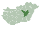
Kunszentmárton is a small town of the county of Jász-Nagykun-Szolnok, central Hungary.
Geography
[edit]Körös River crosses the town from the north-east to the south.
Twin towns – sister cities
[edit]Kunszentmárton is twinned with:[2]
 Teterow, Germany
Sport
[edit]The local football team is the Kunszentmártoni TE .The team three times Jász-Nagykun-Szolnok county Champion and in 1998–99 season they win the Nemzeti Bajnokság III
References
[edit]- ^ KSH, 2018
- ^ "Kunszentmártoni Hír-Lap" (PDF). kunszentmarton.hu (in Hungarian). Kunszentmárton. 2020-06-10. p. 5. Retrieved 2021-04-03.
External links
[edit]Wikimedia Commons has media related to Kunszentmárton.
- Official website in Hungarian


