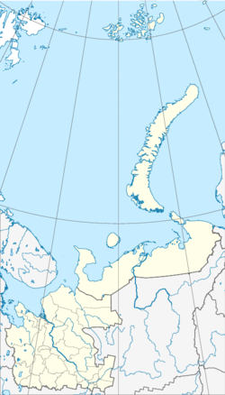
Krasino, Arkhangelsk Oblast
Appearance
Krasino
Kpacинo | |
|---|---|
Work settlement | |
Krasino on Novaya Zemlya | |
| Coordinates: 70°44′11″N 54°27′56″E / 70.73639°N 54.46556°E | |
| Country | Russia |
| Federal subject | Arkhangelsk Oblast |
| Administrative district | Novaya Zemlya District |
| Elevation | 14 m (46 ft) |
| • Urban okrug | Novaya Zemlya Urban Okrug |
Krasino (Russian: Kpacинo) is a small Russian settlement in Arkhangelsk Oblast, on the southern island of Novaya Zemlya. First settled in 1925 due to Soviet Arctic studies, the population was predominantly Russian with a Nenet minority.[1] During the Cold War, Krasino was the centre of the Novaya Zemlya southern test site (NZSTS), which saw air, underwater, and underground tests of nuclear weapons.[2]
There is a lighthouse near the settlement, which is still in working order.[3]
References
[edit]- ^ Serebryanny, Leonid (June 1997). "The Colonization and Peoples of Novaya Zemlya Then and Now". Nationalities Papers. 25 (02): 307. doi:10.1080/00905999708408505.
- ^ Khalturin, Vitaly I.; Rautian, Tatyana G.; Richards, Paul G.; Leith, William S. (January 2005). "A Review of Nuclear Testing by the Soviet Union at Novaya Zemlya, 1955–1990". Science & Global Security. 13 (1–2): 11. doi:10.1080/08929880590961862.
- ^ Rowlett, Russ. "Lighthouses of Russia: Novaya Zemlya". The Lighthouse Directory. University of North Carolina at Chapel Hill. Retrieved 2017-12-30.


