Korokoro, New Zealand
Korokoro | |
|---|---|
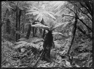
 Native bush with tree ferns, a stream, and two men in right foreground, at Korokoro | |
 | |
| Coordinates: 41°12′54″S 174°52′08″E / 41.215°S 174.869°E | |
| Country | New Zealand |
| City | Lower Hutt |
| Local authority | Hutt City Council |
| Electoral ward | Harbour |
| Community board | Petone Community Board[1] |
| Established | 1900s |
| Area | |
| • Land | 185 ha (457 acres) |
| Population (June 2024)[2] | |
• Total | 1,630 |
| Maungaraki | ||
|
|
Alicetown, Ava | |
| Horokiwi | Petone |

Korokoro, a suburb of Lower Hutt City, lies in the south of the North Island of New Zealand. The suburb occupies part of the western hills of the Hutt Valley; its eastern slopes overlook Petone and the Wellington harbour.
Korokoro was established in the 1900s by the Liberal government (in office 1891–1912), and remained a relatively small settlement until the Lower Hutt City Council developed the area for private housing in the 1960s.[3][failed verification] Before 1989, Korokoro formed part of the Petone Borough,[4] which amalgamated with Lower Hutt City in that year.[5]
Demographics
[edit]Korokoro statistical area covers 1.85 km2 (0.71 sq mi).[6] It had an estimated population of 1,630 as of June 2024,[2] with a population density of 881 people per km2.
| Year | Pop. | ±% p.a. |
|---|---|---|
| 2006 | 1,284 | — |
| 2013 | 1,329 | +0.49% |
| 2018 | 1,482 | +2.20% |
| Source: [7] | ||
Korokoro had a population of 1,482 at the 2018 New Zealand census, an increase of 153 people (11.5%) since the 2013 census, and an increase of 198 people (15.4%) since the 2006 census. There were 540 households, comprising 744 males and 741 females, giving a sex ratio of 1.0 males per female. The median age was 37.9 years (compared with 37.4 years nationally), with 315 people (21.3%) aged under 15 years, 225 (15.2%) aged 15 to 29, 795 (53.6%) aged 30 to 64, and 147 (9.9%) aged 65 or older.
Ethnicities were 85.6% European/Pākehā, 10.9% Māori, 2.0% Pasifika, 10.9% Asian, and 3.0% other ethnicities. People may identify with more than one ethnicity.
The percentage of people born overseas was 24.3, compared with 27.1% nationally.
Although some people chose not to answer the census's question about religious affiliation, 58.5% had no religion, 30.2% were Christian, 0.2% had Māori religious beliefs, 1.2% were Hindu, 0.4% were Muslim, 0.6% were Buddhist and 1.8% had other religions.
Of those at least 15 years old, 501 (42.9%) people had a bachelor's or higher degree, and 87 (7.5%) people had no formal qualifications. The median income was $52,700, compared with $31,800 nationally. 435 people (37.3%) earned over $70,000 compared to 17.2% nationally. The employment status of those at least 15 was that 729 (62.5%) people were employed full-time, 150 (12.9%) were part-time, and 45 (3.9%) were unemployed.[7]
Education
[edit]Korokoro School is a co-educational state primary school for Year 1 to 8 students,[8][9] with a roll of 213 as of August 2024.[10] The school opened in 1904.[11]
References
[edit]- ^ "Hutt City Wards and Suburbs" (PDF). Hutt City Council. Archived from the original (PDF) on 9 February 2013. Retrieved 25 May 2022.
- ^ a b "Aotearoa Data Explorer". Statistics New Zealand. Retrieved 26 October 2024.
- ^ Te Ara: Encyclopedia of New Zealand - Hutt Valley - central and west Retrieved: 24 January 2009
- ^ "The Petone Chronicle". May 2014. Retrieved 10 May 2018.
- ^ "Our history". Hutt City: Te Awa Kairangi. Hutt City Council. Lower Hutt City. 29 September 2017. Archived from the original on 12 October 2020. Retrieved 10 May 2018.
1989 Amalgamation of Lower Hutt, Petone, Wainuiomata and Eastbourne into Lower Hutt City
- ^ "ArcGIS Web Application". statsnz.maps.arcgis.com. Retrieved 7 June 2021.
- ^ a b "Statistical area 1 dataset for 2018 Census". Statistics New Zealand. March 2020. Korokoro (243300). 2018 Census place summary: Korokoro
- ^ "Korokoro School Official School Website". korokoro.school.nz.
- ^ "Korokoro School Education Review Office Report". ero.govt.nz. Education Review Office.
- ^ "Korokoro School Ministry of Education School Profile". educationcounts.govt.nz. Ministry of Education.
- ^ "Korokoro School – 100 years of learning" (PDF). Hutt News. September 2004.
