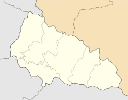
Kolchyno
Appearance
Kolchyno
Кольчино | |
|---|---|
 Street of Kolchyno | |
| Coordinates: 48°28′30″N 22°45′09″E / 48.47500°N 22.75250°E | |
| Country | |
| Oblast | Zakarpattia Oblast |
| Raion | Mukachevo Raion |
| Hromada | Kolchyno settlement hromada |
| First mentioned | 1430 |
| Town status | 1976 |
| Government | |
| • Village Head | Yuriy Udut |
| Elevation | 132 m (433 ft) |
| Population (2022) | |
• Total | |
| Time zone | UTC+2 (EET) |
| • Summer (DST) | UTC+3 (EEST) |
| Postal code | 89636 |
| Area code | +380 3131 |
| Website | http://rada.gov.ua/ |
 | |
Kolchyno (Ukrainian: Кольчино; Hungarian: Kölcsény; Slovak: Kolčino) is a rural settlement in Mukacheve Raion, Zakarpattia Oblast, western Ukraine.[2] The town's population was 4,407 as of the 2001 Ukrainian Census.[2] Current population: 4,198 (2022 estimate).[3]
History
[edit]Until 26 January 2024, Kolchyno was designated urban-type settlement. On this day, a new law entered into force which abolished this status, and Kolchyno became a rural settlement.[4]
References
[edit]- ^ "Kol'chyno (Zakarpattia Oblast, Mukachevo Raion)". weather.in.ua. Retrieved 23 April 2012.
- ^ a b "Kolchyno, Zakarpattia Oblast, Mukachevo Raion". Regions of Ukraine and their Structure (in Ukrainian). Verkhovna Rada of Ukraine. Retrieved 23 April 2012.[permanent dead link]
- ^ Чисельність наявного населення України на 1 січня 2022 [Number of Present Population of Ukraine, as of January 1, 2022] (PDF) (in Ukrainian and English). Kyiv: State Statistics Service of Ukraine. Archived (PDF) from the original on 4 July 2022.
- ^ "Что изменится в Украине с 1 января". glavnoe.in.ua (in Russian). 1 January 2024.


