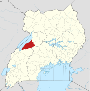
Kibulala, Hoima
Appearance
Kibulala, Hoima | |
|---|---|
| Coordinates: 01°09′00″N 31°00′00″E / 1.15000°N 31.00000°E | |
| Country | |
| Region | Western Region |
| Sub-region | Bunyoro sub-region |
| District | Hoima District |
| Elevation | 4,000 ft (1,220 m) |
Kibulala, Hoima, commonly referred to as "Kibulala", is a hill in Hoima District in the Western Region of Uganda.[citation needed] The name also refers to the human settlement that sits on that hill.[citation needed]
Location
[edit]Kibulala, Hoima is approximately 62 kilometres (39 mi), by road, south-west of Hoima, the nearest large city and the location of the district headquarters, off the Hoima-Kyenjojo road.[1] This location is approximately 250 kilometres (160 mi), by road, west of Kampala, the capital and largest city of Uganda.[2] The approximate coordinates of Kibulala, Hoima are 1°09'00.0"N, 31°00'00.0"E (Latitude:1.1500; Longitude:31.0000).[3]
See also
[edit]References
[edit]- ^ "Map Showing Hoima And Kibulala With Distance Marker". Globefeed.com. Retrieved 31 August 2014.
- ^ "Travel Distance Between Kampala And Kibulala, Hoima With Map". Globefeed.com. Retrieved 31 August 2014.
- ^ Google. "Location of Kibulala, Hoima At Google Maps". Google Maps. Retrieved 31 August 2014.
{{cite web}}:|last=has generic name (help)


