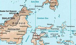
Kaliorang
Appearance
You can help expand this article with text translated from the corresponding article in Indonesian. (February 2024) Click [show] for important translation instructions.
|
Kaliorang | |
|---|---|
 | |
| Coordinates: 0°59′16″N 117°58′48″E / 0.98778°N 117.98000°E | |
| Country | |
| Province | East Kalimantan |
| Regency | East Kutai Regency |
| Area | |
• Total | 370.25 km2 (142.95 sq mi) |
| Population (mid 2023)[1] | |
• Total | 17,682 |
| • Density | 48/km2 (120/sq mi) |
| Time zone | UTC+8 (ICT) |
| Villages | 7 |
Kaliorang is an administrative district (kecamatan) of East Kutai Regency, in East Kalimantan Province of Indonesia. The district to the west of the Karangan River, which empties into Sangkulirang Bay on the east coast of Borneo (Kalimantan). It covers an area of 370.25 km2 and had a population of 7,998 at the 2010 Census and 15,355 at the 2020 Census, while the official estimate as at mid 2023 was 17,682.[1] The district's seat is located in the town of Bangun Jaya.
Villages
[edit]Kaliorang District is divided into the following seven villages (desa), listed below with their areas and their populations according to the mid-2023 official estimates.[1]
| Kode Wilayah |
Name | Area (km2) |
Pop'n Estimate mid 2023 |
|---|---|---|---|
| 64.08.10.2001 | Kaliorang | 50.00 | 2,585 |
| 64.08.10.2006 | Bukit Makmur | 130.18 | 6,384 |
| 64.08.15.2007 | Bukit Harapan | 14.86 | 1,400 |
| 64.08.05.2008 | Cipta Manunggal Jaya | 22.60 | 1,698 |
| 64.08.15.2009 | Bangun Jaya | 13.15 | 2,340 |
| 64.08.15.2010 | Bumi Sejahtera | 32.89 | 1,486 |
| 64.08.15.2013 | Selangkau | 106.57 | 1,789 |
| Totals | Kaliorang | 370.25 | 17,682 |
References
[edit]


