
Istočna Ilidža
Istočna Ilidža
Источна Илиџа East Ilidža | |
|---|---|
 Istočna Ilidža | |
 Coat of arms | |
 Location of Istočna Ilidža within Bosnia and Herzegovina | |
 | |
| Coordinates: 44°15′N 18°41′E / 44.250°N 18.683°E Area/postal codes & others --------> | |
| Country | |
| Entity | |
| City | |
| Government | |
| • Municipal mayor | Marinko Božović (SDS) |
| • Municipality | 27.9 km2 (10.8 sq mi) |
| Population (2013 census) | |
| • Town | 14,241 |
| • Municipality | 14,763 |
| • Municipality density | 530/km2 (1,400/sq mi) |
| Time zone | UTC+1 (CET) |
| • Summer (DST) | UTC+2 (CEST) |
| Postal code | 71123 |
| Area code | 57 |
| Website | www |
Istočna Ilidža (Serbian Cyrillic: Источна Илиџа, lit. East Ilidža) is a municipality in the city of Istočno Sarajevo, Republika Srpska, Bosnia and Herzegovina. It is estimated that in 2020 it had a population of 14.215 inhabitants. Together with Istočno Novo Sarajevo, it is city proper of the city of Istočno Sarajevo and suburban part of the city of Sarajevo.[1] Sarajevo International Airport is located nearby.
History
[edit]
It was created from part of the pre-war municipality of Ilidža (the other part of the pre-war municipality is now in the Canton Sarajevo in the Federation of Bosnia and Herzegovina). The municipality was formerly known as Srpska Ilidža (Serbian Ilidža), as well as Kasindo.
In Istočna Ilidža there is three elementary school "Jovan Dučić" in Kasindo, "Aleksa Šandić" in Vojkovići and "Petar II Petrović Njegoš" in Istočna Ilidža.[2] There is also High School "Istočna Ilidža", located in Istočno Novo Sarajevo.[3]
Istočna Ilidža is homeplace of Administrative center of the Government of the Republika Srpska in Istočno Sarajevo. In neighbourhood Kasindo is located hospital for Istočno Sarajevo. Also, main bus station for Istočno Sarajevo is located in Dobrinja I.[4] The local football club is FK Famos, which competes in the First League of the Republika Srpska.
There have been some proposals for the municipality to be merged with that of Istočno Novo Sarajevo.[5]
Demographics
[edit]Population
[edit]| Population of settlements – Istočna Ilidža municipality | |||
|---|---|---|---|
| Settlement | 1991. | 2013. | |
| Total | 16,754 | 14,763 | |
| 1 | Kasindo / Врдољ | 911 | 539 |
| 2 | Krupac / Лепуван | 232 | |
Ethnic composition
[edit]| Ethnic composition – Istočna Ilidža municipality | |||||||
|---|---|---|---|---|---|---|---|
| 2013. | |||||||
| Total | 14.763 (100,0%) | ||||||
| Serbs | 13.755 (93,17%) | ||||||
| Bosniaks | 648 (4,389%) | ||||||
| Others | 204 (1,382%) | ||||||
| Croats | 156 (1,057%) | ||||||
International cooperation
[edit]Istočna Ilidža is twinned with the following cities and municipalities:
Gallery
[edit]-
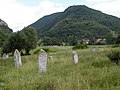 Stećci in Krupac necropolis
 -
 Parts of the modern-day city during the Bosnian war
 -
 Remains of prehistoric fort, late antiquity fort wall pieces and church foundations from the same time period
 -
 New buildings
 -
 Serbian Orthodox church
.jpg)


References
[edit]- ^ "Povećan broj stanovnika u Istočnom Sarajevu". katera.news. 2017-06-18. Retrieved 2017-06-30.
- ^ "Osnovno". istocnailidza.net. 2017-06-18. Retrieved 2017-06-30.
- ^ "Srednjoškolski centar Istočna Ilidža". istocnailidza.net. 2017-06-18. Retrieved 2017-06-30.
- ^ "Znate li kako danas izgleda nekadašnja Lukavica - sada Istočno Sarajevo?!". depo.ba. 2017-06-18. Retrieved 2017-06-30.
- ^ "Glas Srpske". Archived from the original on 2007-09-27. Retrieved 2006-10-29.
- ^ "Bratimljenje Istočne Ilidže sa dvije niške gradske opštine". katera.news. 2017-06-18. Retrieved 2017-06-30.
- ^ "Bratimljenje Istočne Ilidže sa dvije niške gradske opštine". katera.news. 2017-06-18. Retrieved 2017-06-30.
- ^ "Božović potpisao Sporazum o bratimljenju Istočne Ilidže sa ruskim gradom Šuje". citajfilter.com. 2017-06-18. Retrieved 2017-06-30.
External links
[edit]
 | |||||||||||||||
This article about a location in the municipality of Istočna Ilidža, Republika Srpska is a stub. You can help Wikipedia by expanding it. |