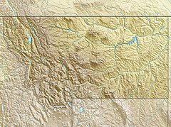
Ipasha Falls
Appearance
| Ipasha Falls | |
|---|---|
| Location | Glacier National Park (U.S.), Montana, U.S. |
| Coordinates | 48°50′54″N 113°48′25″W / 48.8482908°N 113.8069641°W[1] |
| Type | Cascade/Fall |
| Total height | 800 ft (244 m) |
Ipasha Falls is a waterfall located in Glacier National Park, Montana, US. Ipasha Falls descends from Ipasha Glacier to Ipasha Lake and is recorded as having a drop of at least 800 feet (240 m). Located in a remote region north of Many Glacier, the falls can only been seen by a multiday hike on established trails to Mokowanis Lake and then from there along unmaintained trails to Ipasha Lake.[2][3]
References
[edit]- ^ "Ipasha Falls". Geographic Names Information System. United States Geological Survey, United States Department of the Interior. Retrieved December 28, 2019.
- ^ "Ipasha Falls". World Waterfall Database.
- ^ Ahern Pass, MT (Map). TopoQwest (United States Geological Survey Maps). Retrieved December 28, 2019.

