Inagua Airport
Appearance
Inagua Airport Matthew Town Airport | |||||||||||
|---|---|---|---|---|---|---|---|---|---|---|---|
| Summary | |||||||||||
| Airport type | Public | ||||||||||
| Location | Great Inagua island | ||||||||||
| Elevation AMSL | 17 ft / 5 m | ||||||||||
| Coordinates | 20°58′30″N 73°40′01″W / 20.97500°N 73.66694°W | ||||||||||
| Map | |||||||||||
 | |||||||||||
| Runways | |||||||||||
| |||||||||||
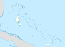
Inagua Airport (also known as Matthew Town Airport) (IATA: IGA, ICAO: MYIG) is a joint civil-military airport in Matthew Town in Inagua in Bahamas. In addition to commercial air service and utilization by general aviation aircraft, it is also home to a U.S. Coast Guard air facility.[2][3]
Airlines and destinations
[edit]| Airlines | Destinations |
|---|---|
| Bahamasair | Nassau, Mayaguana[4] |
References
[edit]- ^ "Airport information for MYIG". World Aero Data. Archived from the original on 2019-03-05. Data current as of October 2006. Source: DAFIF.
- ^ https://coastguardnews.com/coast-guard-medevacs-man-207-miles-of-east-turks-and-caicos/
- ^ https://bryanconstruction.com/portfolio/opbat-hangar-air-station-clearwater-at-u-s-coast-guard-station/
- ^ https://www.flightconnections.com/flights-from-inagua-iga Flight Connections Retrieved 1 February 2022

