Hrafnagil
Appearance
This article needs additional citations for verification. (May 2008) |
Hrafnagil | |
|---|---|
Village | |
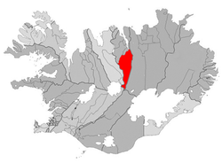
 Location of the Municipality of Eyjafjarðarsveit | |
| Coordinates: 65°34′20″N 18°5′40″W / 65.57222°N 18.09444°W | |
| Country | |
| Constituency | Northeast Constituency |
| Region | Northeastern Region |
| Municipality | Eyjafjarðarsveit |
| Population (2016) | |
• Total | 260 |
| Postal code | 601 |
| Website | Official website |
Hrafnagil (Icelandic pronunciation: [ˈr̥apnaˌcɪːl̥], also known as Hrafnagilshverfi [ˈr̥apnaˌcɪlsˌkʰvɛrvɪ] and formerly Reykárhverfi [ˈreiːkˌaurˌkʰvɛrvɪ][1]) is a small village in Eyjafjarðarsveit, northern Iceland, which in 2016 had 260 inhabitants.
The village has a school and a community center. The area has access to high-temperature geothermal heat, which is used to heat houses and greenhouses.
References
[edit]

