Hostomice (Beroun District)
Hostomice | |
|---|---|
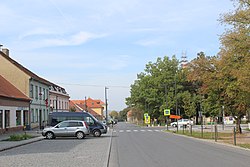
 Tyršovo Square | |
| Coordinates: 49°49′31″N 14°2′44″E / 49.82528°N 14.04556°E | |
| Country | |
| Region | Central Bohemian |
| District | Beroun |
| First mentioned | 1343 |
| Government | |
| • Mayor | Jan Bomba |
| Area | |
• Total | 28.26 km2 (10.91 sq mi) |
| Elevation | 361 m (1,184 ft) |
| Population (2024-01-01)[1] | |
• Total | 1,914 |
| • Density | 68/km2 (180/sq mi) |
| Time zone | UTC+1 (CET) |
| • Summer (DST) | UTC+2 (CEST) |
| Postal code | 267 24 |
| Website | www |
Hostomice is a town in Beroun District in the Central Bohemian Region of the Czech Republic. It has about 1,900 inhabitants.
Administrative parts
[edit]The villages of Bezdědice, Lštěň and Radouš are administrative parts of Hostomice.
Geography
[edit]Hostomice is located about 15 kilometres (9 mi) south of Beroun and 33 km (21 mi) southwest of Prague. It lies mostly in the Hořovice Uplands, including the built-up area. The southern part of the municipal territory, which is hilly and forested, extends into the Brdy Highlands. The highest point is at 644 m (2,113 ft) above sea level. The Chumava Brook flows through the town.
History
[edit]The first written mention of Hostomice is from 1343. From 1357 until the establishment of an independent municipality in 1850, Hostomice was part of the Karlštejn estate. The village was promoted to a town in 1738. Historically, the town is associated with hand-made nails and pottery.[2]
Demographics
[edit]
|
|
| ||||||||||||||||||||||||||||||||||||||||||||||||||||||
| Source: Censuses[3][4] | ||||||||||||||||||||||||||||||||||||||||||||||||||||||||
Transport
[edit]Hostomice is located on the railway line Lochovice–Zadní Třebaň.[5]
Sights
[edit]
Hostomice has a unique town square, which belongs to the largest in the country. The main landmark of the town square is the Church of the Establishment of Saint Peter in Antioch. It is a late Baroque church with a later added tower and an Empire façade. Another landmarks of the town square are a Marian column and a statue of St. John of Nepomuk from 1871.[6][7]
The Church of the Assumption of the Virgin Mary in Bezdědice was first mentioned in 1343. It is originally a Gothic building, which was rebuilt in the Baroque style after a fire in 1779.[6][8]
There is a Jewish cemetery with 160 preserved tombstones at the southwestern municipal border.[6]
Notable people
[edit]- Václav Treitz (1819–1872), pathologist
References
[edit]- ^ "Population of Municipalities – 1 January 2024". Czech Statistical Office. 2024-05-17.
- ^ "Historie Hostomic" (in Czech). Město Hostomice. Retrieved 2023-03-20.
- ^ "Historický lexikon obcí České republiky 1869–2011" (in Czech). Czech Statistical Office. 2015-12-21.
- ^ "Population Census 2021: Population by sex". Public Database. Czech Statistical Office. 2021-03-27.
- ^ "Detail stanice Hostomice p.Brdy" (in Czech). České dráhy. Retrieved 2024-06-05.
- ^ a b c "O městě" (in Czech). Město Hostomice. Retrieved 2023-03-20.
- ^ "Kostel Nastolení sv. Petra v Antiochii" (in Czech). National Heritage Institute. Retrieved 2023-03-20.
- ^ "Kostel Nanebevzetí Panny Marie" (in Czech). National Heritage Institute. Retrieved 2023-03-20.


