Hongshan, Wuhan
Hongshan
洪山区 | |
|---|---|
 Optics Valley Square | |
 | |
| Coordinates: 30°32′16″N 114°24′25″E / 30.5377°N 114.4069°E[1] | |
| Country | People's Republic of China |
| Province | Hubei |
| Sub-provincial city | Wuhan |
| Established date | 1949; reestablished 1955; 1961[2] |
| Area | |
• Total | 480.20 km2 (185.41 sq mi) |
| Elevation | 25.3 m (83.0 ft) |
| Highest elevation | 201 m (659 ft) |
| Lowest elevation | 17.3 m (56.8 ft) |
| Population (2020)[4] | |
• Total | 2,554,403 |
| • Density | 5,300/km2 (14,000/sq mi) |
| Time zone | UTC+8 (China Standard) |
| Postal code | |
| Area code | 0027[6] |
| Website | www |
| Hongshan, Wuhan | |||||||
|---|---|---|---|---|---|---|---|
| Simplified Chinese | 洪山区 | ||||||
| Traditional Chinese | 洪山區 | ||||||
| |||||||
Hongshan District (simplified Chinese: 洪山区; traditional Chinese: 洪山區; pinyin: Hóngshān Qū) forms part of the urban core of and is one of 13 urban districts of the prefecture-level city of Wuhan, the capital of Hubei Province, China. The district is named for Mount Hong, located near East Lake. It is the most populous of all the districts, and is the most spacious but least densely populated among the city's seven core districts.[3]
Geography
[edit]The district is located primarily on the right bank of the Yangtze River but also includes Tianxing Island (天兴洲) and White Sand Island (白沙洲) which are in the Yangtze River. The district borders Wuchang and Qingshan to the north and Jiangxia District to the south; it administers the southern bank of the Yangtze, eastern half of East Lake and the northwest of Tangxun Lake; on the left bank it borders, from west to east, Caidian, Hanyang, Jiang'an, Huangpi, and Xinzhou. The district also borders Huarong District, part of the prefecture-level city of Ezhou.[7] There are several mountains in Hongshan District including Mount Hong (洪山) and Mount Yujia (喻家山/瑜珈山) .[8]
Administrative divisions
[edit]The district contains at least 9 subdistricts and 1 township:[9]
| NBS Area No.[10] | Name (from Mand.) | Chinese (Simp.) | Pinyin | Population (2010)[11] | Area (km2) |
|---|---|---|---|---|---|
| 420111001000 | Luonan Subdistrict | 珞南街道 | Luònán Jiēdào | 230,583 | 13 |
| 420111002000 | Guanshan Subdistrict | 关山街道 | Guānshān Jiēdào | 314,096 | 34 |
| 420111003000 | Shizishan Subdistrict | 狮子山街道 | Shīzishān Jiēdào[citation needed] | 99,255 | 14 |
| 420111004000 | Zhangjiawan Subdistrict | 张家湾街道 | Zhāngjiāwān Jiēdào | 27,028 | 26 |
| 420111005000 | Liyuan Subdistrict | 梨园街道 | Líyuán Jiēdào | 22,384 | 3.76 |
| 420111006000 | Zhuodaoquan Subdistrict | 卓刀泉街道 | Zhuódāoquán Jiēdào | established in Nov 2010 | |
| 420111007000 | Hongshan Subdistrict | 洪山街道 | Hóngshān Jiēdào | 164,992 | 62 |
| 420111008000 | Heping Subdistrict | 和平街道 | Hépíng Jiēdào | 107,811 | 42 |
| 420111009000 | Qingling Subdistrict | 青菱街道 | Qīnglíng Jiēdào | 79,913 | 62.5 |
| 420111205000 | Tianxing Township (T'ien-hsing-chou) | 天兴乡 | Tiānxing Xiāng | 3,368 | 26 |
| 420111460000 | Qingtanhu | 清潭湖/清谭湖办事处 | Qīngtánhú Bànshìchù | 6,438 | |
| 420111491000 | East Lake Scenic Area | 东湖风景区街道(洪山) | Dōnghú Fēngjǐngqū Jiēdào | 53,110 |
Destinations
[edit]Happy Valley Wuhan (simplified Chinese: 欢乐谷; traditional Chinese: 歡樂谷; pinyin: Huānlè Gǔ) is a theme park in Hongshan District. Opened on 29 April 2012, it is the fifth installation of the Happy Valley theme park chain.[12]
Gallery
[edit]-
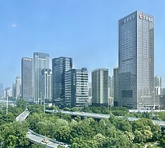
Yuejiazui junction skyine
-
Optics Valley Square
-
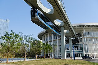
Optics Valley Sky Rail
-
Optics Valley Tramway
References
[edit]- ^ "Hongshan" (Map). Google Maps. Retrieved 2014-07-02.
- ^ 洪山区历史沿革 (in Simplified Chinese). xzqh.org. 7 July 2014. Retrieved 11 December 2017.
- ^ a b Wuhan Statistical Yearbook 2010 (PDF). Wuhan Statistics Bureau. p. 15. Archived from the original (PDF) on November 5, 2011. Retrieved 2011-07-31.
- ^ "China: Húbĕi (Prefectures, Cities, Districts and Counties) - Population Statistics, Charts and Map". www.citypopulation.de. Retrieved 2024-11-22.
- ^ 全国邮编区号搜索. www.ip138.com (in Simplified Chinese). Retrieved 7 December 2017.
市、县、区名 湖北省武汉市洪山区{...} 邮政编码 430070
- ^ a b http://202.108.98.30/defaultQuery?shengji=%BA%FE%B1%B1%CA%A1%28%B6%F5%29&diji=%CE%E4%BA%BA%CA%D0&xianji=%BA%E9%C9%BD%C7%F8 全国行政区划信息查询平台
- ^ 洪山区概况地图 (in Simplified Chinese). xzqh.org. 6 August 2014. Retrieved 11 December 2017.
- ^ "武汉爬山好去处:华中科技大学喻家山- 武汉本地宝".
- ^ 洪山年鉴2016 (PDF) (in Simplified Chinese). Hongshan District government website. p. 22. Archived from the original (PDF) on 6 December 2017. Retrieved 5 December 2017.
截至2011年4月,洪山区辖珞南、关山、狮子山、梨园、和平、洪山、张家湾、青菱、卓刀泉9个街道和1个乡天兴乡。
- ^ 2016年统计用区划代码和城乡划分代码:洪山区 (in Simplified Chinese). National Bureau of Statistics of the People's Republic of China. 2016. Retrieved 7 February 2018.
统计用区划代码 名称 420111001000 珞南街道 420111002000 关山街道 420111003000 狮子山街道 420111004000 张家湾街道 420111005000 梨园街道 420111006000 卓刀泉街道 420111007000 洪山街道办事处 420111008000 和平街道办事处 420111009000 青菱街道 420111061000 八吉府街办事处 420111080000 关东街道办事处 420111081000 花山街道办事处 420111082000 左岭街道办事处 420111083000 九峰街道办事处 420111205000 天兴乡 420111460000 清谭湖办事处 420111491000 东湖风景区街道(洪山)
- ^ 洪山区历史沿革 (in Simplified Chinese). xzqh.org. 7 July 2014. Retrieved 11 December 2017.
- ^ Marden, Duane. "Happy Valley (Wuhan, Hubei, China)". Roller Coaster DataBase. Retrieved 17 November 2012.


