Hollyfort
Appearance
This article needs additional citations for verification. (October 2007) |


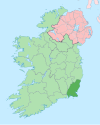
Hollyfort (Irish: Ráth an Chuilinn, meaning 'ringfort of the holly')[1] is a village north of County Wexford, Ireland. It lies within the townland of Mongan (Irish: an Mongán, meaning 'the little swamp') in the valley of the River Bann, 5 km northwest of Gorey.
Like its neighbour Monaseed 4 km to the west, Hollyfort is currently[when?] experiencing the addition of housing, in the form of small housing estates.[citation needed] Unlike Monaseed, the Hollyfort developments are generally within the village area. Hollyfort has a pub, Cooney's, as well as a few abandoned buildings, such as the old bakery and petrol station.[citation needed]
See also
[edit]References
[edit]- ^ "Ráth an Chuilinn / Hollyfort". logainm.ie. Irish Placenames Commission. Retrieved 18 January 2020.

52°43′N 6°21′W / 52.717°N 6.350°W

