Heritage Acres Airport
Appearance
Heritage Acres Airport | |||||||||||
|---|---|---|---|---|---|---|---|---|---|---|---|
| Summary | |||||||||||
| Airport type | Private | ||||||||||
| Serves | Laona, Wisconsin | ||||||||||
| Opened | February 1982 | ||||||||||
| Time zone | CST (UTC−06:00) | ||||||||||
| • Summer (DST) | CDT (UTC−05:00) | ||||||||||
| Elevation AMSL | 1,608 ft / 490 m | ||||||||||
| Coordinates | 45°34′30″N 088°42′30″W / 45.57500°N 88.70833°W | ||||||||||
| Map | |||||||||||
 | |||||||||||
| Runways | |||||||||||
| |||||||||||
| Statistics | |||||||||||
| |||||||||||
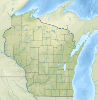
Heritage Acres Airport, (FAA LID: 90WI) is a privately owned airport located 2 miles (3.2 km) northwest of the central business district of Laona, a town in Forest County, Wisconsin, United States.[1]
Although most airports in the United States use the same three-letter location identifier for the FAA and International Air Transport Association (IATA), this airport is assigned 90WI by the FAA but has no designation from the IATA.[2]
Facilities and aircraft
[edit]Heritage Acres Airport covers an area of 10 acres (4.0 ha) at an elevation of 1,608 feet (490 m) above mean sea level. It has one grass runway: 15/33 is 3,000 by 150 feet (914 x 46 m).[1]
In August 2024, there were no aircraft based at this airport.
See also
[edit]References
[edit]- ^ Jump up to: a b c FAA Airport Form 5010 for 90WI PDF. Federal Aviation Administration. effective August 8, 2024.
External links
[edit]- Resources for this airport:
- FAA airport information for 90WI
- AirNav airport information for 90WI
- FlightAware airport information and live flight tracker
- SkyVector aeronautical chart for 90WI


