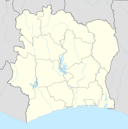
Gaoulou
Appearance
Gaoulou | |
|---|---|
Village | |
| Coordinates: 05°01′55″N 06°09′02″W / 5.03194°N 6.15056°W | |
| Country | |
| District | Bas-Sassandra |
| Region | Gbôklé |
| Department | Sassandra |
| Elevation | 13 m (43 ft) |
| Population (2014) | |
• Total | 12,184 |
| Time zone | UTC+0 (GMT) |
Gaoulou is a village of Sassandra Department, Gbôklé Region, Bas-Sassandra District, Côte d'Ivoire. As of the year 2014, it has a total population of 12,184.[1]
Geography
[edit]Gaoulou is situated on the southern portion of Sassandra Department. It is on the west bank of Sassandra River, approximately 11 kilometres northwest of Sassandra, the capital of Sassandra Department. It has an average elevation of 13 metres above the sea level.[2]
Climate
[edit]Gaoulou has a tropical rainforest climate. On average, it sees the most amount of rainfall in June with 304 mm, and the least in January with 88 mm.
| Climate data for Gaoulou | |||||||||||||
|---|---|---|---|---|---|---|---|---|---|---|---|---|---|
| Month | Jan | Feb | Mar | Apr | May | Jun | Jul | Aug | Sep | Oct | Nov | Dec | Year |
| Mean daily maximum °C (°F) | 30.5 (86.9) |
31 (88) |
31.3 (88.3) |
31 (88) |
29.4 (84.9) |
27.6 (81.7) |
27 (81) |
26.9 (80.4) |
27.8 (82.0) |
28.6 (83.5) |
29.2 (84.6) |
29.6 (85.3) |
29.2 (84.6) |
| Daily mean °C (°F) | 26.2 (79.2) |
26.7 (80.1) |
27 (81) |
26.9 (80.4) |
25.9 (78.6) |
24.7 (76.5) |
24.4 (75.9) |
23.2 (73.8) |
24.5 (76.1) |
25 (77) |
25.4 (77.7) |
25.8 (78.4) |
25.5 (77.9) |
| Mean daily minimum °C (°F) | 23.3 (73.9) |
24 (75) |
24.1 (75.4) |
24.1 (75.4) |
22.5 (72.5) |
22.8 (73.0) |
22.4 (72.3) |
22.4 (72.3) |
22.6 (72.7) |
22.8 (73.0) |
22.9 (73.2) |
23.2 (73.8) |
23.1 (73.5) |
| Average rainfall mm (inches) | 88 (3.5) |
101 (4.0) |
138 (5.4) |
143 (5.6) |
254 (10.0) |
304 (12.0) |
145 (5.7) |
114 (4.5) |
194 (7.6) |
209 (8.2) |
169 (6.7) |
118 (4.6) |
1,977 (77.8) |
| Source: Climate-Data.org[3] | |||||||||||||
References
[edit]- ^ Répertoire des localités, Région du GBÔKLÈ (PDF) (in French). National Institute of Statistic. 2015. p. 22. Archived from the original (PDF) on 22 March 2023.
- ^ "Gaoulou topographic map, elevation, terrain". Topographic maps. Retrieved 22 March 2023.
- ^ "Gaoulou climate: Temperature Sempor & Weather By Month - Climate-Data.org". en.climate-data.org. Retrieved 22 March 2023.

