Fort Good Hope Airport
Appearance
Fort Good Hope Airport | |||||||||||
|---|---|---|---|---|---|---|---|---|---|---|---|
| Summary | |||||||||||
| Airport type | Public | ||||||||||
| Operator | Government of the Northwest Territories | ||||||||||
| Location | Fort Good Hope, Northwest Territories | ||||||||||
| Time zone | MST (UTC−07:00) | ||||||||||
| • Summer (DST) | MDT (UTC−06:00) | ||||||||||
| Elevation AMSL | 267 ft / 81 m | ||||||||||
| Coordinates | 66°14′26″N 128°38′51″W / 66.24056°N 128.64750°W | ||||||||||
| Map | |||||||||||
 | |||||||||||
| Runways | |||||||||||
| |||||||||||
| Statistics (2010) | |||||||||||
| |||||||||||
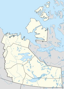
Fort Good Hope Airport (IATA: YGH, ICAO: CYGH) is located 1 nautical mile (1.9 km; 1.2 mi) southwest of Fort Good Hope, Northwest Territories, Canada.
Facilities
[edit]A small terminal building with waiting area is the largest structure. There are no storage hangars at the airport.
Airport runway is gravel, so it handles mainly turboprops (small utility aircraft up to turboprop regional airliner), STOL and other aircraft capable of landing on unpaved or snow covered surfaces.
Airlines and destinations
[edit]The airport connects with a few communities within NWT. Destinations beyond requires connecting flights from Inuvik Airport as there is no direct passenger service to and from Yellowknife Airport.
| Airlines | Destinations |
|---|---|
| North-Wright Airways | Colville Lake, Inuvik, Norman Wells |
Cargo
[edit]| Airlines | Destinations |
|---|---|
| Buffalo Airways | Yellowknife |
References
[edit]- ^ Canada Flight Supplement. Effective 0901Z 16 July 2020 to 0901Z 10 September 2020.
- ^ Synoptic/Metstat Station Information Archived December 1, 2011, at the Wayback Machine
- ^ Total aircraft movements by class of operation
External links
[edit]- Past three hours METARs, SPECI and current TAFs for Fort Good Hope Airport from Nav Canada as available.

