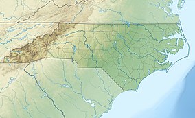
Florence Nature Preserve
| Florence Nature Preserve | |
|---|---|
IUCN category V (protected landscape/seascape)[1] | |
| Location | Henderson County, North Carolina, United States |
| Nearest city | Gerton |
| Coordinates | 35°28′26″N 82°19′57″W / 35.47389°N 82.33250°W |
| Area | 600 acres (240 ha)[2] |
| Elevation | 2,280 ft (690 m) |
| Established | May 4, 2005 |
| Named for | Tom and Glenna Florence |
| Governing body | Conserving Carolina |
Florence Nature Preserve is a publicly-accessible privately owned nature preserve in Gerton, Henderson County, North Carolina in the United States. The 600-acre (2.4 km2)[3] nature preserve is located 18 miles (29 km) southeast of Asheville, North Carolina, and is owned and managed by Conserving Carolina, a local nonprofit, member-supported land trust.
Early park development
[edit]The preserve was named after Dr. Tom and Glenna Florence, who donated the land that makes up the preserve. A 50% interest in the 600 acres was donated to Conserving Carolina, then known as the Carolina Mountain Land Conservancy, in 1996, which was the first property that the land trust owned. The Florence couple went on to donate the remaining 50% interest in the property in 2001. Conserving Carolina adopted and improved nearly five miles of existing trails and has opened the land to the public as the Florence Nature Preserve.[4] Additionally, a small portion of the land is owned by Henderson County Parks.[5]
Recreation
[edit]The preserve contains five hiking trails. Notable sights on the trails include vistas of the summit of Burnshirt Mountain from Rattlesnake Rock, a scenic view of Chimney Rock State Park's Hickory Nut Gorge from Little Pisgah Point, waterfalls, creeks, and various wildlife.
Additionally, an access hiking trail links the park to nearby Little Bearwallow Falls, as well as the interconnected Bearwallow Mountain, Trombatore, and Strawberry Gap trails, all of which are managed by Conserving Carolina.[6] Trails on the preserve are part of the Hickory Nut Gorge State Trail, which may someday connect the preserve to Chimney Rock State Park.[7]
See also
[edit]References
[edit]- ^ Protected Area Profile for Florence Nature Preserve from the World Database on Protected Areas. Retrieved May 23 2023.
- ^ "Size of the North Carolina State Parks System" (XLS). North Carolina Division of Parks and Recreation. July 1, 2020. Archived from the original on August 18, 2020. Retrieved August 17, 2020.
- ^ "Florence Nature Preserve". WNC Magazine. April 15, 2013. Retrieved May 21, 2023.
- ^ "Florence Nature Preserve". Conserving Carolina. Retrieved May 21, 2023.
- ^ "Florence Nature Preserve – Rutherford Outdoor Coalition | NC". Rutherford Outdoor Coalition. Retrieved May 21, 2023.
- ^ "Strawberry Gap Trail, newest link in Hickory Nut Gorge, opens in Henderson County". Hendersonville Times-News. Retrieved May 21, 2023.
- ^ Barrows, Kari (December 20, 2020). "Public input needed for multi-county trail planning". WLOS. Retrieved May 21, 2023.


