
File:Fort Vancouver National Historic Site Area Map.pdf

Size of this JPG preview of this PDF file: 641 × 600 pixels. Other resolutions: 257 × 240 pixels | 513 × 480 pixels | 821 × 768 pixels | 1,094 × 1,024 pixels | 2,458 × 2,300 pixels.
Original file (2,458 × 2,300 pixels, file size: 704 KB, MIME type: application/pdf)
| This is a file from the Wikimedia Commons. Information from its description page there is shown below. Commons is a freely licensed media file repository. You can help. |
Summary
| Description |
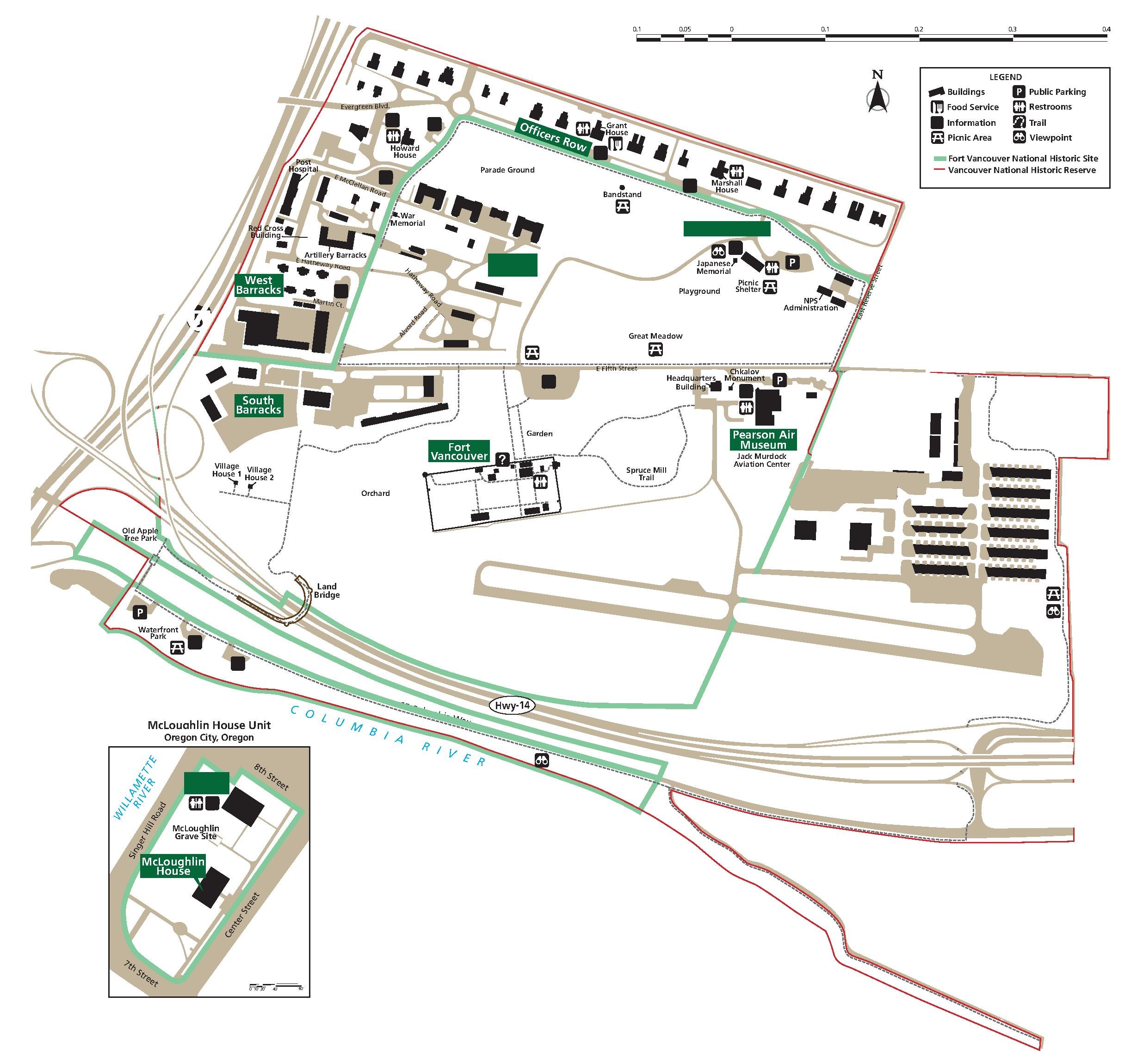
English: Fort Vancouver National Historic Site Area Map |
|||
| Date | Unknown date | |||
| Source | https://www.nps.gov/fova/planyourvisit/maps.htm | |||
| Author | National Park Service | |||
| Permission (Reusing this file) |
|
|||
| Other versions |
.jpeg)
File history
Click on a date/time to view the file as it appeared at that time.
| Date/Time | Thumbnail | Dimensions | User | Comment | |
|---|---|---|---|---|---|
| current | 21:10, 7 December 2019 |  | 2,458 × 2,300 (704 KB) | Senapa | Transferred from https://www.nps.gov/fova/planyourvisit/upload/FVNHR-Map-Accessible-PDF.pdf |
File usage
No pages on the English Wikipedia use this file (pages on other projects are not listed).