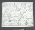
File:A Map of Carolana and of the River Meschacebe etc NYPL434393.tiff
Appearance

Size of this JPG preview of this TIF file: 692 × 599 pixels. Other resolutions: 277 × 240 pixels | 554 × 480 pixels | 887 × 768 pixels | 1,182 × 1,024 pixels | 2,364 × 2,048 pixels | 4,932 × 4,272 pixels.
Original file (4,932 × 4,272 pixels, file size: 60.29 MB, MIME type: image/tiff)
File history
Click on a date/time to view the file as it appeared at that time.
| Date/Time | Thumbnail | Dimensions | User | Comment | |
|---|---|---|---|---|---|
| current | 10:22, 20 April 2014 |  | 4,932 × 4,272 (60.29 MB) | Fæ | GWToolset:: Creating mediafile for Fæ. Tranche 2.590 |
File usage
No pages on the English Wikipedia use this file (pages on other projects are not listed).
Global file usage
The following other wikis use this file:
- Usage on ceb.wikipedia.org

