Fercal
Appearance
Fercal | |
|---|---|
| Região Administrativa de Fercal Administrative Region of Fercal | |
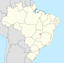
 Location of Fercal in the Federal District | |
| Coordinates: 15°36′06″S 47°52′18″W / 15.60167°S 47.87167°W | |
| Country | Brazil |
| Region | Central-West |
| State | |
| Founded | September 11, 1956 |
| Area | |
• Total | 182 km2 (70 sq mi) |
| Population | |
• Total | 8,536 |
| • Density | 47/km2 (120/sq mi) |
| Time zone | UTC−3 (BRT) |
| Area code | +55 61 |
| Website | www |
Fercal is an administrative region in the Federal District in Brazil. Fercal was founded on September 11, 1956, receiving the status of administrative region, according to Law 4745, of January 29, 2012.


