El Crucero, Tequixquiac
Appearance
El Crucero | |
|---|---|
Town | |
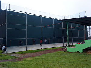
 Unidad Deportiva Once Hermanos del Necaxa. | |
| Coordinates: 19°54′9″N 99°8′7″W / 19.90250°N 99.13528°W | |
| Country | |
| State | State of Mexico |
| Region | Zumpango Region |
| Municipality | Tequixquiac |
| Founded | 1954 |
| Area | |
• Total | 10.83 km2 (4.18 sq mi) |
| Elevation (of seat) | 2,230 m (7,320 ft) |
| Population (2010) | |
| • Town | 134[1] |
| Time zone | UTC-6 (CST) |
| Postal code (of seat) | 55654 |
| Website | http://www.tequixquiac.gob.mx/ |
El Crucero is a village in the Tequixquiac municipality, Mexico State in Mexico.[2] The town is bordered on the north La Heredad Ranch, south to the town of Santiago Tequixquiac, east town of Tlapanaloya and west by the Apaxco municipality.[3] [4]
References
[edit]- ^ Catalogo de localidades Archived 2016-03-04 at the Wayback Machine Tequixquiac Municipality. SEDESOL, November 20, 2017.
- ^ Localidades de México Belediye de Tequixquiac, 20 de Noviembre de 2017.
- ^ Cline, Howard F. (7 January 2014). Handbook of Middle American Indians, Volume 12: Guide to Ethnohistorical Sources (in Spanish). ISBN 9781477306826. Archived from the original on 2007-05-27. Retrieved 2008-11-27.
- ^ Rodríguez Peláez, María Elena, Monografía Municipal de Tequixquiac, Instituto Mexiquense de Cultura, Toluca de Lerdo, 1999, p.p. 14.

