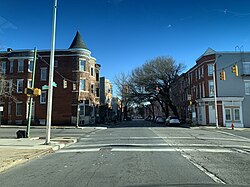
Druid Heights, Baltimore
Appearance
Druid Heights | |
|---|---|
 View south from Druid Hill Avenue at intersection with Gold Street in Druid Heights, Baltimore | |
| Coordinates: 39°18′31″N 76°38′16″W / 39.30861°N 76.63778°W | |
| Country | |
| State | |
| City | |
| City Council | District 11 |
| Area | |
• Total | 0.0905 sq mi (0.234 km2) |
| Population (2020) | |
• Total | 1,267 |
| • Density | 14,000/sq mi (5,000/km2) |
| [1] | |
| Time zone | UTC−5 (Eastern) |
| • Summer (DST) | UTC−4 (EDT) |
| ZIP Codes | 21217 |
| Area Codes | 410, 443, 667 |
Druid Heights is a neighborhood in west Baltimore.
Geography
[edit]Druid Heights is bounded by North Avenue to the north, Madison Avenue and McCulloh Street to the east, Laurens Street and Bloom Street to the south, and Pennsylvania Avenue to the west. Adjacent neighborhoods are Penn-North (northwest), Reservoir Hill (northeast), Madison Park (east), Upton (south), and Sandtown-Winchester (west).[2]
References
[edit]- ^ "2020 Census Preliminary Demographics Data Explorer by Neighborhood Statistical Area". Baltimore City Department of Planning. Baltimore City Department of Planning & Data Analysis Division. 2020. Retrieved April 18, 2022.
- ^ Baltimore's Neighborhood Statistical Areas (PDF) (Map). City of Baltimore Department of Planning. December 20, 2016. Retrieved April 18, 2022.


