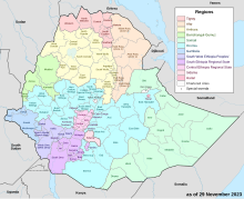
Dirashe Zone

Gardula Zone is one of the zones in the South Ethiopia Regional State of Ethiopia. In 2011, the Segen Area Peoples Zone was established, which includes Dirashe woreda and the 3 former special woredas surrounding it.[1] It is named for the Dirashe people, whose homelands lie in the eastern part of this woreda. Dirashe got zonal status when the South Ethiopia Regional State formed in August 2023.
Overview
[edit]Located in the Great Rift Valley, Dirashe is bordered on the south by Konso Zone, on the west by the Weito River which separates it from the Debub Omo Zone, on the north by the Gamo Zone, on the northeast by Lake Chamo, and on the east by Amaro Zone. The administrative center of Dirashe zone is Gidole.
According to a 2004 report, Dirashe had 57 kilometers of all-weather roads and 44 kilometers of dry-weather roads, for an average road density of 66 kilometers per 1000 square kilometers.[2] High points in Dirashe include Mount Gardolla (2545 meters).
History
[edit]In April 2002, several persons were killed and numerous houses were burned during fighting over a land dispute between the Dirashe and the Zayse. Local ruling party officials had incited the violence between the previously peaceful groups.[3] By the end of the following year, the responsible local officials, who included the former woreda administrator, were found guilty of inciting the violence between the previously peaceful groups.[4]
Human Rights Watch interviewed farmers on 25 June 2009, who claimed that they had been dispossessed of their lands and forced out of their homes for supporting opposition parties.[5]
Demographics
[edit]Based on the 2007 Census conducted by the Central Statistical Agency of Ethiopia (CSA), this zone has a total population of 142,758, of whom 70,111 are men and 72,647 women. With an area of 1,487.38 square kilometers, Dirashe has a population density of 95.98; 13,184 or 9.24% are urban inhabitants. A total of 26,838 households were counted in this zone, which results in an average of 5.32 persons to a household, and 26,102 housing units. The eight largest ethnic groups reported in this woreda were the Dirashe (45.01%), the Gawwada (27.94%), the Mossiya (9.27%), the Kusumie (5.08%), the Mashole (4.34%), the Konso (2.35%), the Gamo (1.76%), and the Amhara (1.62%); all other ethnic groups made up 2.63% of the population. Dirashe was spoken as a first language by 47.51% of the inhabitants, 27.43% spoke Gawwada, 9.09% spoke Bussa, 4.82% spoke Oromiffa, 4.1% spoke Amharic, 3.66% spoke Gamo, and 1.76% spoke Konso; the remaining 1.63% spoke all other primary languages reported. 50.03% were Protestants, 34.27% practiced Ethiopian Orthodox Christianity, and 12.84% of the population said they practiced traditional religions.[6]
In the 1994 Census, Dirashe had a population of 89,900 in 17,181 households, of whom 45,617 were men and 49,038 women; 8,167 or 9.08% of its population were urban dwellers. The five largest ethnic groups reported in this woreda were the Dirashe (58.44%), the Gawwada (19.75%), the Mossiya (10.06%), the Amhara (2.99%), and the Konso (2.34%); all other ethnic groups made up 6.48% of the population. Dirashe was spoken as a first language by 55.08% of the inhabitants, 19.64% spoke Gawwada, 7.26% spoke Bussa, 5.41% spoke Oromiffa, and 4.97% spoke Amharic; the remaining 7.64% spoke all other primary languages reported.[7] 51.63% of the population said they practiced traditional religions, 35.46% were Protestants, and 10.38% practiced Ethiopian Orthodox Christianity.[8] Concerning education, 17.49% of the population were considered literate; 9.69% of children aged 7–12 were in primary school; 3.2% of the children aged 13–14 were in junior secondary school, and 3.48% of the inhabitants aged 15–18 were in senior secondary school.[9] Concerning sanitary conditions, about 74% of the urban houses and 19% of all houses had access to safe drinking water at the time of the census; 64% of the urban and 12% of the total had toilet facilities.[10]
Notes
[edit]- ^ Moges, Misganaw Addis (2014). Practice of Self-Government in the Southern Nations Nationalities and Peoples’ Regional State: The Case of Segen Area Peoples’ Zone (Thesis). p. 5. Retrieved 2022-12-23.
- ^ "Detailed statistics on roads" Archived July 20, 2011, at the Wayback Machine, SNNPR Bureau of Finance and Economic Development website (accessed 15 September 2009)
- ^ "Ethiopia: Country Reports on Human Rights Practices: 2002 report", Bureau of Democracy, Human Rights, and Labor, US State Department (accessed 9 July 2009)
- ^ "Ethiopia: Country Reports on Human Rights Practices: 2003 report", Bureau of Democracy, Human Rights, and Labor, US State Department (accessed 9 July 2009)
- ^ "One Hundred Ways of Putting Pressure", p. 36. Human Rights Watch report, released 10 March 2010
- ^ Census 2007 Tables: Southern Nations, Nationalities, and Peoples' Region Archived November 13, 2012, at the Wayback Machine, Tables 2.1, 2.4, 2.5, 3.1, 3.2 and 3.4.
- ^ 1994 Population and Housing Census of Ethiopia: Results for Southern Nations, Nationalities, and Peoples' Region, Vol. 1, part 1 Archived November 19, 2008, at the Wayback Machine, Tables 2.1, 2.7, 2.12, 2.15 (accessed 30 December 2008)
- ^ 1994 Population and Housing Census of Ethiopia: Results for Southern Nations, Nationalities, and Peoples' Region, Vol. 2 Archived November 20, 2008, at the Wayback Machine, Table 2.21 (accessed 27 March 2009)
- ^ 1994 Population and Housing Census of Ethiopia: Results for Southern Nations, Nationalities, and Peoples' Region, Vol. 1, part 2 Archived November 19, 2008, at the Wayback Machine, Tables 3.5, 3.7 (accessed 17 April 2009)
- ^ 1994 Population and Housing Census of Ethiopia: Results for Southern Nations, Nationalities, and Peoples' Region, Vol. 1, part 2 Archived November 19, 2008, at the Wayback Machine, Tables 6.3, 6.11, 6.13 (accessed 17 April 2009)
