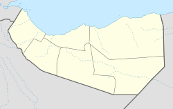
Dayaha
Appearance
Dayaha (Somali: Dayaxa) is a town in the Sanaag region of Somaliland.[1][2][3]
Dayaha
Dayaxa | |
|---|---|
Town | |
| Coordinates: 10°34′58″N 47°11′11″E / 10.58278°N 47.18639°E | |
| Country | |
| Region | Sanaag |
| District | Erigavo District |
| Population (2002[4]) | |
| • Total | 3,800 |
| Time zone | UTC+3 (EAT) |
Overview
[edit]Dayaha is 20km west of Erigavo, the administrative seat of the Sanaag region the town lies in. Other nearby cities and towns include Burao (363km), El Afweyn (85km) and Garadag (160km).[5][6][7]
Demographics
[edit]Dayaha is exclusively populated by the Muse Abokor Aduruxmiin [citation needed]sub-division of the Habar jeclo Isaaq.[8]
See also
[edit]- Administrative divisions of Somaliland
- Regions of Somaliland
- Districts of Somaliland
- Somalia–Somaliland border
References
[edit]- ^ Morel, Emilien. "Sunrise and sunset Dayaxa Sanaag Somalia". Weather Avenue. Retrieved 2021-01-24.
- ^ "Mindat.org". zh.mindat.org. Retrieved 2021-01-24.
- ^ "Murrashaxa KULMIYE oo soo Dhaweyn iyo Hadhimo-sharafeed is Huwan Deegaanka DAYAXA loogu Sameeyey". Retrieved 2021-05-10.
- ^ unicef (September 2002). "SANAAG REGION NUTRITION SURVEY REPORT" (PDF). Archived from the original (PDF) on 2021-07-11. Retrieved 2021-07-11.
- ^ "Distance between Dayaxa, Sanaag Somalia SO and Erigavo, Sanaag Somalia SO (Sanaag,Somalia)". distancecalculator.globefeed.com. Retrieved 2021-01-24.
- ^ "El Afweyn till Dayaha". El Afweyn till Dayaha (in Swedish). Retrieved 2021-05-10.
- ^ "Burao till Dayaha". Burao till Dayaha (in Swedish). Retrieved 2021-05-10.
- ^ Hunt, John Anthony (1951). A General Survey of the Somaliland Protectorate 1944-1950: Final Report on "An Economic Survey and Reconnaissance of the British Somaliland Protectorate 1944-1950," Colonial Development and Welfare Scheme D. 484. To be purchased from the Chief Secretary.


