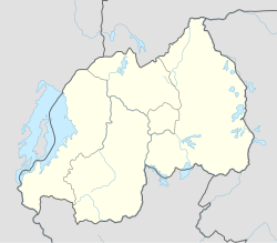
Cyanika
Cyanika | |
|---|---|
Village and sector | |
| Coordinates: 01°20′40″S 29°44′32″E / 1.34444°S 29.74222°E | |
| Country | |
| Province | Northern Province |
| District | Burera District |
| Area | |
• Village and sector | 40 km2 (20 sq mi) |
| Elevation | 1,957 m (6,421 ft) |
| Population (2022 census)[1] | |
• Village and sector | 44,510 |
| • Density | 1,100/km2 (2,900/sq mi) |
| • Urban | 8,881 |
| Time zone | UTC+2 (CAT) |
Cyanika is a village in Rwanda. It sits adjacent to Kyanika, across the international border with neighboring Uganda.[2] Cyanika, also refers to Cyanika Sector, one of the 17 administrative divisions of Burera District.[3]
Location
[edit]Cyanika is located in Cyanika Sector, Burera District, Northern Province, approximately 121 kilometres (75 mi), by road, north-west of Kigali, the capital and largest city of Rwanda.[4] The geographical coordinates of Cyanika, Burera District, Rwanda are: 1°20'40.0"S, 29°44'32.0"E (Latitude:-1.344444; Longitude:29.742222).[5] Cyanika sits at an average elevation of 1,957 metres (6,421 ft), above sea level.[6]
Overview
[edit]Cyanika/Kyanika is one of the three major road crossings between Rwanda to the south and Uganda to the north. The other to are Gatuna/Katuna and Kagitumba/Mirama Hills.[7]
In February 2019, Rwanda closed its borders to Ugandans and Ugandan goods, including at the Chanika/Kyanika border crossing. As a result, the annual trade worth approximately US$180 million to Uganda and about US$10 million to Rwanda came to a halt.[8] As of February 2020, attempts by the presidents of Angola, João Lourenço and of the Democratic Republic of the Congo, Félix Tshisekedi, have not yet resolved the impasse.[9]
Points of interest
[edit]The border crossing is in close proximity to Volcanoes National Park in Rwanda, Mgahinga Gorilla National Park in Uganda, and Virunga National Park, in the Democratic Republic of the Congo.[2]
References
[edit]- ^ citypopulation.de
- ^ a b Volcanoes National Park (Not affiliated with Rwanda Development Board) (2019). "The Cyanika border is a very important key for tourism in Uganda & Rwanda". Volcanoes National Park (Not affiliated with Rwanda Development Board). Archived from the original on 10 December 2019. Retrieved 11 March 2019.
- ^ Rwanda Village Makeover (2015). "Village Makeover: Cyanika". Rwandavillagemakeover.com. Archived from the original on 8 March 2016. Retrieved 11 March 2019.
- ^ Globefeed.com (11 March 2019). "Distance between Kigali, Rwanda and Cyanika, Burera, Rwanda". Globefeed.com. Retrieved 11 March 2019.
- ^ "Location of Cyanika, Burera District, Rwanda" (Map). Google Maps. Retrieved 11 March 2019.
- ^ Mapcarta (2019). "Elevation of Cyanika, Burera, Rwanda". Mapcarta.com Map. Retrieved 11 March 2019.
- ^ Muhereza, Robert (10 March 2019). "Ugandan goods denied entry into Rwanda". Daily Monitor. Kampala. Retrieved 11 March 2019.
- ^ Catherine Byaruhanga (9 March 2019). "How the Rwanda-Uganda border crossing came to a halt". London: BBC Africa News. Retrieved 7 February 2020.
- ^ Daily Monitor (2 February 2020). "Museveni, Kagame resolve to release prisoners". Daily Monitor. Kampala. Retrieved 8 February 2020.

