Csenger
Appearance
Csenger | |
|---|---|
| Coordinates: 47°50′N 22°41′E / 47.833°N 22.683°E | |
| Country | |
| County | Szabolcs-Szatmár-Bereg |
| District | Csenger |
| Area | |
• Total | 36.16 km2 (13.96 sq mi) |
| Population (2015)[1] | |
• Total | 4,870 |
| • Density | 130/km2 (350/sq mi) |
| Time zone | UTC+1 (CET) |
| • Summer (DST) | UTC+2 (CEST) |
| Postal code | 4765 |
| Area code | (+36) 44 |
| Website | www |
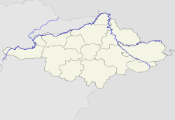
Csenger is a town in Szabolcs-Szatmár-Bereg county, in the Northern Great Plain region of eastern Hungary. It is known for being the poorest town in Hungary. In 2023, the Hungarian Prison Service Headquarters announced that it is constructing a new prison in the town, with inmates producing metal and wooden furnishings for the new facility.[2]
Geography
[edit]The town covers an area of 36.16 km2 (14 sq mi) and has a population of 4,870 people (2015). It lies on left bank of the river Szamos, on the border with Romania.
Twin towns – sister cities
[edit] Covasna, Romania
 Hauenstein, Germany
 Negrești-Oaș, Romania
 Tășnad, Romania
 Vetiș, Romania
References
[edit]- ^ Gazetteer of Hungary, 1 January 2015. Hungarian Central Statistical Office.
- ^ "Hungarian Inmates Assist in the Furnishing of the High-Tech Csenger Prison". HungarianConservative.com.
- ^ "Testvérvárosaink". csenger.hu (in Hungarian). Csenger. Archived from the original on 13 April 2021. Retrieved 3 April 2021.
External links
[edit]Wikimedia Commons has media related to Csenger.
- Official website in Hungarian


