Cosío
Cosío | |
|---|---|
 Interactive map | |
 | |
| Coordinates: 22°22′N 102°18′W / 22.367°N 102.300°W | |
| Country | Mexico |
| State | Aguascalientes |
| Municipal seat | Cosío |
| Area | |
• Total | 129.21 km2 (49.89 sq mi) |
| Population (2015) | |
• Total | 15,577 |
| • Density | 120/km2 (310/sq mi) |
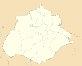
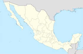
Cosio is a municipality and town in the Mexican state of Aguascalientes. It stands at 22°22′N 102°18′W / 22.367°N 102.300°W. The municipal seat is the town of Cosío. As of 2020, the town of Cosío had a population of 17,000.[1]
Name
[edit]Cosío is said to have been named after either former Governor of Aguascalientes Felipe Cosío [2] or Luis de Cosío, who had an instrumental part in helping Cosío become a municipality.[3]
Coat of Arms
[edit]A large outline of the letter C framing the other elements holds the town motto, "Siempre Progresando." At the top, a simplified illustration the landscape. On the left, a map of the territory with a maguey plant, a cactus, a church, main roads, and a bee representing its inhabitant's industriousness. On the right, a book with the symbol for writing or a torch. At the bottom, cultivated land with a tractor, watering equipment, and commonly cultivated crops including grapes. [2]
History
[edit]Founding
[edit]Cosío was founded December 28, 1857.[2]
Before then, the area was part of neighboring municipality Rincon de Romos and belonged to the San Jacinto hacienda, owned by Pío Bermejillo. A tenant of the hacienda, Cornelio Acosta, asked for permission to build in the area and founded Natillas Ranch. Due to its positioning at the northernmost part of Aguascalientes, Natillas was used as a rest stop for those traveling between the state and the bordering state of Zacatecas.[3]
Demographics
[edit]| Year | Pop. | ±% |
|---|---|---|
| 2010 | 15,042 | — |
| 2015 | 15,577 | +3.6% |
| 2020 | 17,000 | +9.1% |
| [4][5][6][7] | ||
2010
[edit]In 2010, the municipality had a total population of 15,042.[8]
As of 2010, the town of Cosío had a population of 4,898.[8] Other than the town of Cosío, the municipality had 85 localities, the largest of which (with 2010 populations in parentheses) were: La Punta (2,416), El Refugio de Providencia (Providencia) (1,377), El Salero (1,229), and Santa María de la Paz (1,026), classified as rural.[8]
2020
[edit]Population
[edit]By 2020, the population increased to 17,000.[1]
| Count | Percent | |
|---|---|---|
| Female | 8708 | 51.2% |
| Male | 8292 | 48.8% |
| Disabled | 805 | 0.05% |
| Indigenous | 15 | 0.0009% |
| Afro-Mexican | 2155 | 0.13% |
| Elderly (65+) | 1118 | 0.07% |
Geography
[edit]Climate
[edit]| Climate data for Cosío (1951–2010) | |||||||||||||
|---|---|---|---|---|---|---|---|---|---|---|---|---|---|
| Month | Jan | Feb | Mar | Apr | May | Jun | Jul | Aug | Sep | Oct | Nov | Dec | Year |
| Record high °C (°F) | 28.0 (82.4) |
32.0 (89.6) |
32.0 (89.6) |
34.0 (93.2) |
36.0 (96.8) |
36.0 (96.8) |
34.0 (93.2) |
32.0 (89.6) |
31.5 (88.7) |
32.0 (89.6) |
31.0 (87.8) |
28.0 (82.4) |
36.0 (96.8) |
| Mean daily maximum °C (°F) | 21.0 (69.8) |
22.8 (73.0) |
25.6 (78.1) |
27.6 (81.7) |
29.4 (84.9) |
28.7 (83.7) |
26.8 (80.2) |
26.4 (79.5) |
25.8 (78.4) |
25.1 (77.2) |
23.6 (74.5) |
21.5 (70.7) |
25.4 (77.7) |
| Daily mean °C (°F) | 12.5 (54.5) |
13.9 (57.0) |
16.4 (61.5) |
18.8 (65.8) |
20.8 (69.4) |
21.0 (69.8) |
19.9 (67.8) |
19.6 (67.3) |
19.1 (66.4) |
17.5 (63.5) |
14.9 (58.8) |
13.1 (55.6) |
17.3 (63.1) |
| Mean daily minimum °C (°F) | 4.0 (39.2) |
5.1 (41.2) |
7.1 (44.8) |
10.1 (50.2) |
12.3 (54.1) |
13.4 (56.1) |
13.1 (55.6) |
12.7 (54.9) |
12.4 (54.3) |
10.0 (50.0) |
6.3 (43.3) |
4.7 (40.5) |
9.3 (48.7) |
| Record low °C (°F) | −5.0 (23.0) |
−4.0 (24.8) |
−0.5 (31.1) |
1.0 (33.8) |
3.0 (37.4) |
7.0 (44.6) |
8.5 (47.3) |
8.0 (46.4) |
3.5 (38.3) |
1.0 (33.8) |
−2.5 (27.5) |
−7.0 (19.4) |
−7.0 (19.4) |
| Average precipitation mm (inches) | 22.8 (0.90) |
9.5 (0.37) |
2.8 (0.11) |
8.1 (0.32) |
20.6 (0.81) |
60.0 (2.36) |
99.5 (3.92) |
82.6 (3.25) |
66.5 (2.62) |
30.2 (1.19) |
7.7 (0.30) |
11.2 (0.44) |
421.5 (16.59) |
| Average precipitation days (≥ 0.1 mm) | 2.6 | 1.5 | 1.0 | 2.0 | 4.0 | 7.9 | 11.2 | 10.0 | 8.8 | 4.7 | 1.8 | 2.5 | 58.0 |
| Source: Servicio Meteorologico Nacional[10][11] | |||||||||||||
Main Highways
[edit]Federal
[edit]State
[edit]- Carretera Estatal 25
- Carretera Estatal 26
- Carretera Estatal 39
- Carretera Estatal 50
- Carretera Estatal 62
- Carretera Estatal 64
- Carretera Estatal 147
Neighboring Municipalities
[edit]Distances
[edit]- Aguascalientes: 34 miles.
- Asientos: 27 miles.
- Calvillo 66 miles.
- Jesús María 30 miles.
- Rincón de Romos 9 miles.
Economy
[edit]Main Sectors, Products, and Services
[edit]Agriculture
[edit]Most of the municipality's agriculture is irrigated.
Perennial
[edit]Spring and Summer
[edit]Autumn and Winter
[edit]Livestock
[edit]Industry
[edit]Small industrial plants and workshops, a glove assembly plant, a children's clothing factory, balcony workshops and some extraction of minerals.
Commerce
[edit]Many commercial establishments, grocery stores, butcher shops and bakeries.
Services
[edit]Telephone services and means of transport such as taxis and buses are offered.
Fishing
[edit]Fishing can be practiced in the Natillas dam, which mainly has the species of bass, tilapia and mojarra.
Socioeconomic Status
[edit]Cosío is significantly more disadvantaged socioeconomically compared the rest of Aguascalientes as a whole.
| Population | Compared to State | ||
|---|---|---|---|
| Vulnerability | Count | Percent | |
| Social Only | 5138 | 32.2% | +6.6% |
| Economic Only | 1583 | 9.9% | -1.2% |
| Moderate Poverty | 5366 | 33.7% | +8.5% |
| Extreme Poverty | 538 | 3.4% | +1% |
| Not Vulnerable | 3316 | 20.8 | +14.9% |
Lack of Access to Basic Necessities
[edit]Access to Utilities
[edit]| Population Lacking Access | ||||
|---|---|---|---|---|
| Necessity | Count (thousands) | % | Households | % |
| Water | 3.1 | 18.1% | 671 | 17.1% |
| Plumbing | 0.2 | 1.3% | 61 | 1.6% |
| Electricity | 0.1 | 0.3% | 14 | 0.4% |
| Chimneys
(when cooking with wood or charcoal indoors) |
0.3 | 1.5% | 70 | 1.8% |
Housing Issues
[edit]| Population Experiencing Issue | ||||
|---|---|---|---|---|
| Issue | Count (thousands) | % | Households | % |
| Dirt Floors | 0.2 | 1.0% | 31 | 0.8% |
| Flimsy Roofing | 0.1 | 0.7% | 25 | 0.6% |
| Flimsy Walls | 0.1 | 0.9% | 31 | 0.8% |
| Overcrowded Homes | 1.3 | 7.7% | 196 | 5.0% |
References
[edit]- ^ a b "Censo de Población y Vivienda 2020". www.inegi.org.mx. Retrieved August 3, 2024.
- ^ a b c "Cosío". Gobierno del Estado de Aguascalientes. Retrieved August 3, 2024.
- ^ a b "Fundación". Cosío, Aguascalientes. Retrieved August 3, 2024.
- ^ "Localidades y su población por municipio según tamaño de localidad" (PDF) (in Spanish). INEGI. Archived from the original (PDF) on August 31, 2018. Retrieved July 15, 2017.
- ^ "Número de habitantes". INEGI (National Institute of Statistics and Geography). Archived from the original on July 2, 2017. Retrieved July 15, 2017.
- ^ "Tabulados de la Encuesta Intercensal 2015" (xls) (in Spanish). INEGI. Archived from the original on December 31, 2017. Retrieved July 15, 2017.
- ^ "INEGI. Censo de Población y Vivienda 2020. Tabulados del Cuestionario Básico – Aguascalientes" [INEGI. 2020 Population and Housing Census. Basic Questionnaire Tabulations – Aguascalientes] (Excel) (in Spanish). INEGI. 2020. pp. 1–4. Archived from the original on January 28, 2021. Retrieved January 27, 2021.
- ^ a b c "Cosío". Catálogo de Localidades. Secretaría de Desarrollo Social (SEDESOL). Archived from the original on February 23, 2018. Retrieved April 23, 2014.
- ^ a b c d Unidad de Planeación y Evaluación de Programas para el Desarrollo (2022). "Informe anual sobre la situación de pobreza y rezago social 2022" (PDF). Gobierno de Mexico: Bienestar. Retrieved August 2, 2024.
- ^ "Estado de Aguascalientes-Estacion: Cosio". Normales Climatologicas 1951–2010 (in Spanish). Servicio Meteorologico Nacional. Archived from the original on May 18, 2015. Retrieved May 8, 2015.
- ^ "Extreme Temperatures and Precipitation for Cosio 1978–2010" (in Spanish). Servicio Meteorológico Nacional. Archived from the original on May 18, 2015. Retrieved May 8, 2015.


