Columbia Turnpike-West Tollhouse
Appearance
Columbia Turnpike-West Tollhouse | |
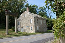
 The former toll house as seen on NY 23B in September 2016. | |
| Location | NY 23B, Greenport, New York |
|---|---|
| Coordinates | 42°14′21″N 73°45′37″W / 42.23917°N 73.76028°W |
| Area | less than one acre |
| Built | 1800 |
| Architectural style | Federal |
| NRHP reference No. | 00001571[1] |
| Added to NRHP | December 28, 2000 |
Columbia Turnpike-West Tollhouse is a historic tollhouse located at Greenport in Columbia County, New York. It was built about 1800 and is a 2+1⁄2-story, three bay square limestone building with a medium pitched gable roof. It operated along the Columbia Turnpike and served as the tollkeeper's residence and in use as such until 1907, when the road was turned over to the county and then the state.[2] The state designated the road as New York State Route 23 until that route was realigned southwest towards the Rip Van Winkle Bridge in the 1950s and the segment along the toll house was redesignated as New York State Route 23B.
It was added to the National Register of Historic Places in 2000.[1]
See also
[edit]References
[edit]- ^ a b "National Register Information System". National Register of Historic Places. National Park Service. March 13, 2009.
- ^ Peter D. Shaver (November 1999). "National Register of Historic Places Registration: Columbia Turnpike-West Tollhouse". New York State Office of Parks, Recreation and Historic Preservation. Retrieved 2010-07-03. See also: "Accompanying six photos".
Categories:
- Houses on the National Register of Historic Places in New York (state)
- Federal architecture in New York (state)
- Houses completed in 1800
- Houses in Columbia County, New York
- Toll houses on the National Register of Historic Places
- National Register of Historic Places in Columbia County, New York
- Columbia County, New York Registered Historic Place stubs


