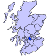
Chryston
Chryston
| |
|---|---|
 Chryston Parish Church | |
| Population | 3,100 (2022)[1] |
| OS grid reference | NS681701 |
| Lieutenancy area | |
| Country | Scotland |
| Sovereign state | United Kingdom |
| Post town | GLASGOW |
| Postcode district | G69 9 |
| Police | Scotland |
| Fire | Scottish |
| Ambulance | Scottish |
| UK Parliament | |
| Scottish Parliament | |
Chryston is a village in North Lanarkshire, around 7 miles (11 km) east of Glasgow, in Scotland. It lies north of its sister village, Muirhead, which is on the A80.[2] The village has around double Muirhead's population, although the exact boundary between the two modern villages is difficult to find.
History
[edit]

The etymology of the name is uncertain but may refer to the "town of Cristinus".[5] Several old documents show Chryston with various spellings including maps by Timothy Pont,[6] William Forrest, Thomas Richardson,[7] and William Roy.[8]
In the 18th century, Chryston had one of the four schools in the parish of Cadder. William Barclay, himself a school teacher, reported the low pay of his profession in the Old Statistical Account.[9]
One gazetteer, Samuel Lewis, from around 1846, describes a recently established library. He quotes 555 inhabitants.[10] The same publication also stated that Chyston was a quoad sacra parish including the villages of Mollinsburn, Moodiesburn, Muirhead and the hamlet of Auchinloch. Even today Moodiesburn is often included in the Chryston district: Devro headquarters has Chryston as its official address, and Moodiesburn's Stoneyetts Hospital (originally part of East Muckcroft within the "Woodilee Estate") was sometimes listed under Chryston.[11][12]
On Friday 18 September 1959, 47 miners lost their lives in the Auchengeich mining disaster at Auchengeich Colliery situated in nearby Moodiesburn.
Chryston High School is a six-year non-denominational secondary school situated on Lindsaybeg Road.[13]
Demography
[edit]Groome's Gazetteer gives historical statistics including population.[14] The 1891 and 1901 statistics include Muirhead.[15]
| Year | Chryston Population | Quoad Sacra Parish Population |
|---|---|---|
| 1836[16] | 374 | _ |
| 1841 | _ | 2,670 |
| 1846 | 555 | _ |
| 1861 | 582 | _ |
| 1871 | 486 | 3,203 |
| 1881 | 464 | 3,240 |
| 1891 | 899 | _ |
| 1901 | 1,102 | _ |
See also
[edit]External links
[edit]References
[edit]- ^ "Mid-2020 Population Estimates for Settlements and Localities in Scotland". National Records of Scotland. 31 March 2022. Retrieved 31 March 2022.
- ^ "OS 25 inch 1892-1949". National Library of Scotland. Ordnance Survey. Retrieved 26 October 2017.
- ^ Blaeu, Joan. "Glottiana Praefectura Inferior". National Library of Scotland. Retrieved 30 December 2017.
- ^ "Chryston on Pont 34". Maps of Scotland. Timothy Pont (16th century). Retrieved 31 December 2017.
- ^ Drummond, Peter, John (2014). An analysis of toponyms and toponymic patterns in eight parishes of the upper Kelvin basin (PDF). Glasgow: Glasgow University. p. 155. Retrieved 3 July 2017.
{{cite book}}: CS1 maint: multiple names: authors list (link) - ^ "Christoun on Pont's Map". NLS. Pont. Retrieved 24 February 2018.
- ^ "Old County Maps". NLS. Retrieved 27 January 2018.
- ^ "Roy's map of the Lowlands". NLS. Retrieved 27 January 2018.
- ^ Barclay, William (1791). The statistical account of Scotland. Drawn up from the communications of the ministers of the different parishes (Vol 8 ed.). Edinburgh: W. Creech. pp. 480–481. Retrieved 2 March 2018.
- ^ Lewis, Samuel (1846). A topographical dictionary of Scotland ... London: S. Lewis and Co. p. 198. Retrieved 24 February 2018.
- ^ Stoneyetts Hospital, Glasgow. The National Archives. Retrieved 23 June 2011.
- ^ Tough, Alistair (23 July 1998). "NHS Greater Glasgow and Clyde Archives: Records". University of Glasgow. Retrieved 23 June 2011.
- ^ "Chryston High School – #WeAreChrystonHighSchool".
- ^ Groome, Francis Hindes (1882). Ordnance gazetteer of Scotland : a survey of Scottish topography, statistical, biographical, and historical (Vol 1 ed.). Edinburgh: T.C. Jack. p. 261. Retrieved 24 February 2018.
- ^ Eleventh decennial census of the population of Scotland taken 31st March 1901, with report : volume I. HMSO. 1902. p. 278. Retrieved 2 March 2018.
- ^ The new statistical account of Scotland by Society for the Benefit of the Sons and Daughters of the Clergy. Vol. 6. Edinburgh and London: W. Blackwood and Sons. 1836. p. 408.


