
Category:Canadian public domain photographs
In Canada, copyright protection normally lasts until 50 years after the author's death (50 years p.m.a.) since 1999. However, under the old Copyright Act, photographs were protected only for 50 years after their creation. When Bill C-32: An Act to Amend the Copyright Act came into effect on January 1, 1999, photographs whose copyright already had expired remained in the public domain. As a result, Canadian photographs taken before January 1, 1949 and not under Crown copyright are in the public domain in Canada. See also [1] at the bottom. Such images may be tagged using {{PD-Canada}}, which populates this category. Note that one also has to determine whether an image so tagged also is in the public domain in the U.S. (Note: Under a 2018 trade treaty with the United States, some Canadian works may have an extended copyright term of 70 years since the authors death. If this situation applies to an image found in this category, please update the file description to use an appropriate non-free license, and add a fully complete non-free use rationale.)
Pages in category "Canadian public domain photographs"
This category contains only the following page. This list may not reflect recent changes.
Media in category "Canadian public domain photographs"
The following 200 files are in this category, out of 251 total.
(previous page) (next page)-
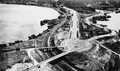
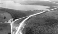 7A - CausewayAerial60.png 741 × 436; 317 KB
-
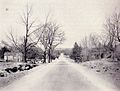
 15 north through Barriefield, 1920s.jpg 784 × 590; 47 KB
-
 17 near Kenora, 1939.png 585 × 418; 405 KB
-
 17B Thessalon 1920.png 1,527 × 1,144; 1 MB
-
 18A map.png 670 × 500; 984 KB
-
 21 and 82 in Port Franks.jpg 550 × 340; 36 KB
-
 21 Redirection near Goderich.jpg 704 × 377; 70 KB
-
 27 widening and Toronto Bypass construction, 1954.png 2,738 × 1,916; 5.56 MB
-
 36 south of Bobcaygeon, 1934.jpg 566 × 427; 87 KB
-
 48 and 401 cloverleaf.png 722 × 543; 516 KB
-
 71 Lake of the Woods 1939.png 676 × 407; 808 KB
-
 71 Sioux Narrows, 1951.png 501 × 500; 736 KB
-
 72 Frog Rapids Narrows, 1938.png 642 × 378; 384 KB
-
 73 at Copenhagen.png 477 × 365; 284 KB
-
 101 construction between Chapleau and Foleyet, 1961.png 620 × 424; 565 KB
-
 401 pre-widening at Keele, March 21, 1958.jpg 688 × 553; 111 KB
-
 401-DVP interchange.png 369 × 369; 400 KB
-
 402 exiting Sarnia, 1959.png 1,195 × 599; 505 KB
-
 417 Alta Vista overpass 1961.png 646 × 411; 203 KB
-
 417 west from Carling.png 380 × 488; 284 KB
-
 420 Approaching Rainbow Bridge, 1941.png 750 × 507; 293 KB
-
 420 Approaching Rainbow Bridge, 1942.jpg 750 × 508; 188 KB
-
 1873-melville.gif 550 × 340; 82 KB
-
 1923 Ontario Road Map rear.png 4,000 × 2,531; 12.18 MB
-
 1923 Ontario Road Map.png 4,000 × 2,887; 12.4 MB
-
 1926 ORM - Sarnia to London.png 408 × 264; 210 KB
-
 1931-32 - Essex County.png 695 × 501; 766 KB
-
 1938 map of Highway 29.png 240 × 337; 208 KB
-
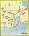 1958 Ontario Road Map - Kingston inset.png 433 × 537; 527 KB
-
 Air Chief Marshal Frank R Miller.jpg 200 × 252; 29 KB
-
 Alberta Provincial Police Logo.png 286 × 347; 156 KB
-
 Arrest at city hall 1942.jpg 400 × 477; 30 KB
-
 Avenue Road north towards Wilson Avenue, April 26, 1940.png 944 × 545; 457 KB
-
 Badge of the High Sheriff of Newfoundland.png 713 × 1,085; 401 KB
-
 Bayview Finch looking east, 1960.png 1,020 × 809; 2.37 MB
-
 BondsorBondage.JPG 444 × 437; 82 KB
-
 BurnestHeardPostcard.png 219 × 347; 113 KB
-
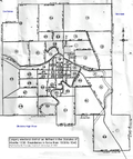 Calgary electoral district 1930.png 968 × 1,153; 851 KB
-
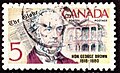 Canada Stamp - George Brown.jpg 347 × 211; 39 KB
-
 Canadian-Valenciennes.jpg 480 × 371; 59 KB
-
 CH-14 and CH-15 HS-22592.jpg 1,793 × 1,397; 1,021 KB
-
 Chambersrobert.jpg 326 × 388; 38 KB
-
 Charles Dunning Land Grant.jpg 604 × 471; 83 KB
-
 Charles Edward Bothwell.jpg 155 × 230; 27 KB
-
 Clappison cut 3.png 640 × 398; 286 KB
-
 Clappison cut 4.png 640 × 513; 362 KB
-
 Colonization road in 1901, colourised.png 576 × 561; 466 KB
-
 Colonization road in 1901.png 576 × 561; 286 KB
-
 Cotter joseph henry.jpg 450 × 600; 20 KB
-
 Cotton duck manufactured by the Imperial Cotton Company Limited.jpg 5,184 × 3,456; 8.14 MB
-
 Daniel-Jérémie Décarie.jpg 277 × 361; 21 KB
-
 DeltaOntario1930s 1.jpg 800 × 480; 103 KB
-
 Departure of Coast and Interior Salish Chief's Delegation to England, 1906.jpg 3,000 × 1,668; 412 KB
-
 Don Roadway 1910.png 960 × 658; 840 KB
-
 DYK SQ Esther Hill, studio portrait, circa 1923–1928.jpg 193 × 198; 29 KB
-
 Edward LeRoy Bowerman.jpg 151 × 230; 30 KB
-
 Emma Stark.png 182 × 300; 59 KB
-
-
 Fenian raids.jpg 400 × 310; 20 KB
-
 Ferguson Highway south of Bracebridge, 1930.png 832 × 434; 417 KB
-
 FortEdmontonCirca1900.jpg 640 × 489; 20 KB
-
 Frederick Campbell VC.jpg 254 × 358; 16 KB
-
 Frederick William Borden.jpg 142 × 230; 21 KB
-
 Garden City Skyway, September 1963.png 1,574 × 2,011; 3.13 MB
-
 Gen Sir Edward Hutton.jpg 250 × 334; 22 KB
-
 George Doucett cuts ribbon on completed Highway 40, October 27, 1943.png 530 × 259; 134 KB
-
 George Russell Boucher.jpg 151 × 230; 28 KB
-
 Geraldon to Hearst construction camp.png 909 × 651; 992 KB
-
 GG-Julian Byng.jpg 250 × 300; 58 KB
-
 Ground Observer Corps Tower.jpg 1,404 × 1,117; 182 KB
-
 Halifaxgazette.jpg 600 × 972; 155 KB
-
 Harry James Barber.jpg 162 × 230; 28 KB
-
 Harry Strom.JPG 282 × 352; 11 KB
-
 Henry Hague Davis.jpg 250 × 362; 15 KB
-
 HenryNathan.png 142 × 230; 22 KB
-
 Highway 4 north of St. Thomas, June 23, 1948.png 748 × 524; 766 KB
-
 Highway 5 near Clappison's Corners, 1955.png 1,219 × 850; 1.99 MB
-
 Highway 6 south of Guelph, 1921.png 2,048 × 1,730; 2.44 MB
-
 Highway 8 between Stratford and Sebringville, 1922.png 983 × 422; 638 KB
-
 Highway 8 south of Galt, 1921.png 988 × 439; 413 KB
-
 Highway 11 at Crown Hill, 1931.png 620 × 443; 348 KB
-
 Highway 31 at Cass Bridge.png 932 × 561; 683 KB
-
 Highway 120 at French River, 1955.png 2,100 × 960; 2.75 MB
-
 Highway 400 and 88, 1962.png 789 × 495; 325 KB
-
 HMCS Buctouche K179 badge O-893-288.jpg 2,801 × 1,881; 2.32 MB
-
 HMCS-Prince-David-Paul-Muni.png 877 × 700; 426 KB
-
 Holland Marsh 1946.png 741 × 565; 1.2 MB
-
 Honghowardferguson.jpg 200 × 224; 6 KB
-
 Huron Road 1858.png 596 × 326; 215 KB
-
 Hwy 30 at Trent River, 1935.png 1,300 × 797; 1.53 MB
-
 If day map.jpg 800 × 943; 120 KB
-
 Jackfish 1906.jpg 500 × 332; 143 KB
-
 James Bowman.jpg 118 × 192; 20 KB
-
 James Maclennan.jpg 250 × 362; 23 KB
-
 JamesAlbertManningAikins.png 142 × 230; 20 KB
-
 JamesBarclay-b1826.jpg 1,295 × 1,583; 439 KB
-
 JeremiahDeVeber.jpg 142 × 230; 24 KB
-
 John Gordon Greenshields.png 282 × 353; 111 KB
-
 John Hampden Burnham.jpg 120 × 194; 24 KB
-
 John Henry Wilson.jpg 336 × 480; 14 KB
-
 John M. Gibbons and Ernest Manning.jpg 254 × 300; 27 KB
-
 John Morison Gibson.jpg 369 × 480; 34 KB
-
 JohnChipmanWade.jpg 142 × 230; 22 KB
-
 JohnYeo.jpg 150 × 176; 5 KB
-
 Joseph Featherston.jpg 156 × 252; 34 KB
-
 Joseph-Arthur Bradette.jpg 155 × 230; 28 KB
-
 Junobeach Landing1.jpg 600 × 463; 94 KB
-
 Junobeach Landing2.jpg 600 × 449; 88 KB
-
 Kahnawake-white conflit 1907.jpg 1,197 × 1,524; 1.1 MB
-
 King-citizen.jpg 450 × 472; 60 KB
-
 Kingston Road at Danforth, 1938.png 609 × 426; 279 KB
-
 LaBolduc1.jpg 191 × 273; 15 KB
-
 Lakeview School Regina 1941.jpg 500 × 311; 26 KB
-
 Landclaim.jpg 1,441 × 1,926; 1.37 MB
-
 Lomer Brisson.jpg 164 × 230; 29 KB
-
 Longwoods Extension.png 600 × 353; 348 KB
-
 LoranEllisBaker.jpg 151 × 230; 28 KB
-
 Lt. Gov at Bow Valley 1901.jpg 500 × 412; 68 KB
-
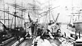 Lumber ships, Hastings Sawmill, Vancouver, 1890.jpg 3,000 × 1,679; 533 KB
-
 Marchioness of Dufferin and Ava.jpg 889 × 1,287; 875 KB
-
 Marine Building 1929.png 165 × 200; 40 KB
-
 Maypole Dance, Qu'Appelle, 1919.jpg 218 × 248; 10 KB
-
 MCJCoursol.jpeg 142 × 230; 25 KB
-
 Mcoldconstruction.jpg 178 × 300; 21 KB
-
 McQuesten opens QEW, 1940.png 792 × 518; 458 KB
-
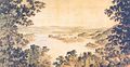 Melville Island 1801.jpg 598 × 309; 47 KB
-
 Melville Island, 1878.gif 550 × 347; 84 KB
-
 Melville Rysdale Ten Broeke.png 164 × 279; 57 KB
-
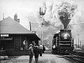
 Melville-depot.JPG 590 × 374; 32 KB
-
 Mission (Ustlawn) Squamish Indian Reserve, seen from Vancouver. ca. 1903.jpg 3,000 × 2,178; 603 KB
-
 Model Bakery employees, Spink Mills, Pickering, Ontario, 1902.jpg 646 × 415; 161 KB
-
 Moilesstreet.jpg 404 × 288; 16 KB
-
 Moncton ICR station crop.jpg 300 × 190; 42 KB
-
 Monument to James Fletcher.jpg 760 × 613; 113 KB
-
 Moro-captured.jpg 600 × 717; 182 KB
-
 Mount Stephen House.jpg 768 × 473; 350 KB
-
 New France House.jpg 760 × 452; 55 KB
-
 New St. George underpass, 1932.png 619 × 467; 241 KB
-
 Nipigon River Bridge under construction July 1937.png 1,600 × 1,008; 1.79 MB
-
 Nov1838woman.jpg 1,700 × 2,338; 1.39 MB
-
 NSARM51442.jpg 450 × 259; 28 KB
-
 NSARMQE185A2.jpg 450 × 262; 21 KB
-
 O'Brien's Bridge, Ontario Highway 37 - June 25, 1952.png 940 × 542; 631 KB
-
 Official badge of Royal Canadian Air Force Station North Bay.jpg 1,135 × 1,744; 493 KB
-
 Ofi 1909-001 s01 200 cln.jpg 10,802 × 3,971; 4.51 MB
-
 Ofi 1926-001 200 cln.jpg 4,975 × 2,050; 2.82 MB
-
 Ofm 1942-001 200 cln.jpg 6,972 × 5,922; 3.66 MB
-
 OldDelhiOntarioTrainStation.jpg 271 × 203; 16 KB
-
 OM Biggar WWI Portrait.jpg 255 × 415; 29 KB
-
 ON 29 south of Smiths Falls, 1943.png 1,963 × 1,367; 3.58 MB
-
 ON 41 bypass north of Roblin.png 816 × 543; 972 KB
-
 ON 45 south of Finella.jpg 812 × 547; 116 KB
-
 ON 105 at Cedar Lake.jpg 610 × 390; 64 KB
-
 ON 105 south of Red Lake.jpg 647 × 462; 126 KB
-
 ON 117 Baysville 1964.jpg 1,087 × 766; 347 KB
-
 Ontario 407.png 236 × 376; 21 KB
-
 Opening of Nipigon River Bridge.png 1,600 × 1,001; 1.51 MB
-
 Orange Orphanage Indian Head.jpg 452 × 290; 20 KB
-
 Oswald Smith Crocket.jpg 250 × 362; 16 KB
-
 Ottawa St facing east at at Henry Sturm Blvd, 1961.png 570 × 405; 183 KB
-
 Ottawa-Prescott Highway prior to 1919.png 658 × 526; 660 KB
-
 Page 99 of Wilson Township Organizational Meeting 1914.jpg 1,700 × 2,800; 2.05 MB
-
 Palgrave elm tree hotel.jpg 225 × 156; 22 KB
-
 Paving Sarnia-London Highway, 1927.png 953 × 395; 489 KB
-
 Percy Chapman Black.jpg 158 × 230; 20 KB
-
 PeterVeregin1903.jpg 260 × 369; 27 KB
-
 Pioneer Days Pagent - Stirling, Alberta - July 24, 1930.jpg 1,392 × 361; 209 KB
-
 Portrait of Robert MacLaren Fowler.png 298 × 371; 151 KB
-
 Prairie Queen Hotel.jpg 560 × 286; 82 KB
-
 Princess Sophia (steamship) ca 1912) cropped.jpg 608 × 447; 69 KB
-
 Proudly She Marches.jpg 367 × 272; 21 KB
-
 QEW - 420 Interchange.png 522 × 427; 260 KB
-
 QEW Bronte Creek bridge expansion.png 2,154 × 1,720; 2.45 MB
-
 QEW from Mimico, February 3, 1958.png 910 × 546; 496 KB
-
 QEW Shook's Hill interchange, 1961.png 730 × 547; 482 KB
-
 Qu'Appelle Progress newspaper office, 1900.jpg 362 × 237; 16 KB
-
 Queenston Road, Cape Horn, 1918.png 666 × 430; 313 KB
-
 Radial car at Bond Lake.jpg 876 × 559; 120 KB
-
-
 RCAF No. 3 All-Weather (Fighter) Operational Training Unit pilot and jet.jpg 9,561 × 7,807; 5.54 MB
-
 Rcnas cadets 1918 PA-135769.jpg 1,985 × 1,390; 789 KB
-
 Reconstruction of 27.png 478 × 362; 349 KB
-
 Regina 11th Ave East 1920s.jpg 760 × 487; 53 KB
-
 Rff-ww1.JPG 401 × 356; 23 KB
-
 Rff-ww2.JPG 294 × 356; 17 KB
-
 Richard John Cartwright.jpg 142 × 230; 22 KB
-
 Richard Langton Baker.jpg 162 × 230; 28 KB
-
 Rmacd.jpg 179 × 344; 10 KB
-
 RNathanielDett.jpg 600 × 991; 176 KB
-
 Robert jones.jpg 114 × 173; 4 KB
-
 Robert L. Kahn Dalhousie Yearbook 1945.png 187 × 248; 96 KB
-
 RobertLairdBorden.jpg 142 × 230; 9 KB
-
 Robertson Macaulay.jpg 444 × 459; 118 KB
-
 Rodolphe Laflamme.jpg 465 × 651; 274 KB
-
 Rollo Mainguy.jpeg 1,000 × 1,310; 143 KB
-
 Sandwich Street, Windsor in 1863.jpg 600 × 425; 43 KB
-
 Scotia Junction Ontario Canada a020594.jpg 760 × 526; 76 KB
-
 Second World War Return From Night Flying Training.jpg 2,385 × 2,449; 906 KB
-
 Sedley Cudmore.jpg 226 × 337; 67 KB
-
 ShipwreckCamp1914.jpg 735 × 486; 62 KB


_Squamish_Indian_Reserve,_seen_from_Vancouver._ca._1903.jpg)


_ca_1912)_cropped.jpg)


_Operational_Training_Unit_pilot_and_jet.jpg)


