Category:Aerial photographs of Ontario roads
Appearance
Media in category "Aerial photographs of Ontario roads"
The following 19 files are in this category, out of 19 total.
-
35 north of Coboconk.jpg 640 × 456; 67 KB
-
402 through Sarnia.png 1,979 × 1,085; 3.98 MB
-
403 near Jerseyville.png 3,028 × 2,018; 10.03 MB
-
416 into Ottawa.png 800 × 600; 694 KB
-
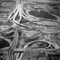
427 and QEW reconstruction, 1967.png 315 × 317; 130 KB
-
Conestoga and Freeport interchange.png 3,264 × 2,448; 10.76 MB
-
Conestoga Parkway North.png 2,448 × 3,215; 9.37 MB
-
Downtown Waterloo.png 3,264 × 2,448; 9.93 MB
-
Garden City Skyway, September 1963.png 1,574 × 2,011; 3.13 MB
-
Hanlon Parkway interchange.png 3,264 × 1,014; 4.34 MB
-
Hespeler Bypass cropped.png 2,448 × 2,536; 8.9 MB
-
Hespeler Bypass.png 2,448 × 3,264; 10.09 MB
-
Highway 8 and Freeport Diversion facing south.png 2,350 × 3,095; 8.42 MB
-
Highway 24 west of Guelph.png 3,264 × 2,448; 10.26 MB
-
Highway 85 southbound into Conestoga Parkway.png 2,448 × 2,877; 7.68 MB
-
Highway 401 and Freeport Diversion facing east.png 3,264 × 2,448; 10.64 MB
-
Hwy 420 and Horseshoe Falls.png 2,048 × 1,052; 3.86 MB
-
QEW Bronte Creek bridge expansion.png 2,154 × 1,720; 2.45 MB
-
Waterloo Regional Road 17.png 3,264 × 2,359; 9.15 MB


