Butterburn Flow
Appearance
| Site of Special Scientific Interest | |
| Location | Cumbria |
|---|---|
| Grid reference | NY673763 |
| Coordinates | 55°04′48″N 2°30′49″W / 55.080064°N 2.5137330°W |
| Area | 1,011 acres (4.1 km2; 1.6 sq mi) |
| Notification | 1984 |
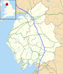
Butterburn Flow is a Site of Special Scientific Interest (SSSI)[1][2] in Cumbria, England. It is located north of Greenhead. Some of the borders of this protected area follow the River Irthing. This protected area contains important blanket bog habitat that occurs over deep peat.
Details
[edit]This protected area contains large extents of blanket bog that are intact. Moss species include Sphagnum magellanicum, Sphagnum papillosum, Sphagnum pulcrum and Sphagnum imbricatum. Plant species recorded in this protected area include bog rosemary and cloudberry.[1]
There are no paths on this site.[3]
Land ownership and management
[edit]All of the land within Butterburn Flow SSSI is owned by the Forestry Commission.[4] The site is managed by the Northumberland Wildlife Trust.[3]
References
[edit]- ^ a b "SSSI detail". designatedsites.naturalengland.org.uk. Retrieved 2024-11-29.
- ^ "Protected Planet | Butterburn Flow". Protected Planet. Retrieved 2024-11-29.
- ^ a b "Butterburn Flow | Northumberland Wildlife Trust". www.nwt.org.uk. Retrieved 2024-11-29.
- ^ "Mapping the habitats of England's ten largest institutional landowners". Who owns England?. 2020-10-06. Retrieved 2024-11-29.

