Buruntuma
Appearance
Buruntuma | |
|---|---|
Village | |
 Border post at Buruntuma | |
| Coordinates: 12°26′N 13°39′W / 12.433°N 13.650°W | |
| Country | |
| Region | Gabú Region |
| Sector | Piche |
| Time zone | UTC+0 (GMT) |
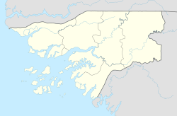
Buruntuma is a village in the Gabú Region of north-eastern Guinea-Bissau. It lies on the border with Guinea, to the southeast of Canquelifá.[citation needed]
History
[edit]On 24 February 1970, a group of terrorists attacked Buruntuma with heavy guns and grenades; it became known as the "Buruntuma massacre".[1]
References
[edit]- ^ Eppstein, John (1972). Does God say kill?: an investigation of the justice of current fighting in Africa. Tom Stacey Ltd. p. 129. ISBN 978-0-85468-204-1.

