Brown Passage
Appearance
| Brown Passage | |
|---|---|
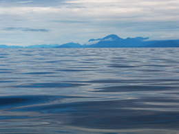
 Looking northward across Brown Passage.webp | |
| Location | British Columbia, Canada |
| Coordinates | 54°19′24″N 130°48′42″W / 54.32333°N 130.81167°W |
Brown Passage is a deep (up to 200 m) ocean channel connecting the western offshore waters of Hecate Strait and Dixon Entrance on the Pacific continental shelf with the eastern inland waters of Chatham Sound in the North Coast of British Columbia, Canada.[1]
Located between Dundas and Stephens Islands, the passage is part of the main commercial approach to Prince Rupert.[2] The western entrance is guarded by the Triple Island Lighthouse.
Brown Passage was named in July 1793 by Captain Vancouver, after Captain William Brown, of the Butterworth, which vessel Vancouver met with at the north end of Stephens Island on 21 July 1793.[1]
References
[edit]- ^ a b "Brown Passage". BC Geographical Names.
- ^ "Port Description : Prince Rupert Port Authority". Prince Rupert Port Authority. Retrieved 2021-07-09.
The main commercial approach to Prince Rupert is via the Dixon Entrance, Brown Passage and Chatham Sound passing Lucy Island, Rachael Islands and the Kinahan Islands traveling SE towards Ridley Island and Lelu Island.

