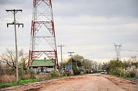
Brazo Largo
Appearance
You can help expand this article with text translated from the corresponding article in Spanish. (May 2010) Click [show] for important translation instructions.
|
Brazo Largo | |
|---|---|
village | |
 Main street in Brazo Largo | |
 | |
| Country | |
| Province | Entre Ríos Province |
| Department | Islas de Ibicuy |
| Municipality | Villa Paranacito |
| Time zone | UTC−3 (ART) |


Brazo Largo is a village in the municipality of Villa Paranacito in the Islas del Ibicuy department in Entre Ríos Province in north-eastern Argentina. There is a railway station some 8 km west of the village, along the General Urquiza Railway.[1]
References
[edit]- ^ Ministerio del Interior (in Spanish)
