Bovenkerk, Krimpenerwaard
Appearance
Bovenkerk | |
|---|---|
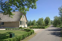
 Farm in Bovenkerk | |
 The village (dark green) and the statistical district (light green) of Bovenkerk in the former municipality of Vlist | |
| Coordinates: 51°58′N 4°47′E / 51.967°N 4.783°E | |
| Country | Netherlands |
| Province | South Holland |
| Municipality | Krimpenerwaard |
| Population (1 January 2020) | |
• Total | 245 |
| Time zone | UTC+1 (CET) |
| • Summer (DST) | UTC+2 (CEST) |
Bovenkerk is a village in the municipality of Krimpenerwaard in the province of South Holland, Netherlands. Bovenkerk was part of the municipality of Vlist until 1 January 2015, when it was absorbed in the newly-formed municipality of Krimpenerwaard. It lies east of the town of Stolwijk, about 7 km (4.3 mi) southeast of Gouda.
Population
[edit]The statistical area of Bovenkerk, which also can include the surrounding countryside, has a population of around 245.[1]
References
[edit]- ^ Statistics Netherlands (CBS), Statline: Kerncijfers wijken en buurten 2020. As of 1 January 2020.
