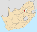
Blyvooruitzicht
Blyvooruitzicht | |
|---|---|
| Coordinates: 26°24′4.42″S 27°24′6.39″E / 26.4012278°S 27.4017750°E | |
| Country | South Africa |
| Province | Gauteng |
| District | West Rand |
| Municipality | Merafong City |
| Area | |
• Total | 3.71 km2 (1.43 sq mi) |
| Population (2011)[1] | |
• Total | 698 |
| • Density | 190/km2 (490/sq mi) |
| Racial makeup (2011) | |
| • Black African | 84.2% |
| • White | 15.8% |
| First languages (2011) | |
| • Xhosa | 26.8% |
| • Afrikaans | 15.2% |
| • Tswana | 12.3% |
| • Sotho | 10.5% |
| • Other | 35.2% |
| Time zone | UTC+2 (SAST) |
Blyvooruitzicht (locally /ˈbleɪfʊəreɪtsəxt/ BLAY-foor-ayt-səkht;[2] Afrikaans pronunciation: [ˈblɛifuərœitsəχt]) is a gold mine and gold-mining village in Gauteng, South Africa. It is situated about 5 kilometres (3.1 mi) south of the centre of Carletonville and 80 kilometres (50 mi) westwards from Johannesburg.
History of the village
[edit]The name of the village is of Dutch origin meaning "happy prospect". The farm Blyvooruitzicht was first farmed by Pieter Daniël Roux and the main road through the current village is named after him.[3] Established in 1937, Blyvooruitzicht village was built to house the workers of the Blyvooruitzicht Gold Mine which was the first to mine the gold of the West Wits line. In the late 60's and early 70's it boasted having the highest earnings per capita in the world.
History of the mine
[edit]Production started in 1942 under the ownership of Rand Mines. Later ownership passed to DRD (in 1997), then Village Main Reef and more recently Blyvoor Gold.
Sinkholes
[edit]| External images | |
|---|---|
During the night of 3 August 1964, a sinkhole in the former mining village township of Westdene, Blyvooruitzight, buried the entire Oosthuizen family and their domestic worker, alive. Situated some 5.5 kilometres (3.4 mi) south of Carletonville, as one of four village townships at the Blyvooruitzight Gold Mine, Westdene, was consequently abandoned. The subsequent housing shortage was quickly normalised by extending the Southdene village township situated some 400 metres (1,300 ft) south of the sinkhole, with pre-fabricated asbestos housing. Unknown at the time, asbestos was since proclaimed and banned as a health hazard, but the houses are still occupied today.
An ancient sinkhole southwest of the village called the Hutgrot Cave was the shelter of the Batswana tribes during the Mzilikazi raids.[citation needed]
Places of interest
[edit]The Villagers
[edit]Blyvoor mine and village was the setting for a SABC TV soap opera filmed in the 1970s called "The Villagers (TV Series 1976)".
Isidingo
[edit]The highest point in the village is a hill called "Isidingo", which is where the mine manager's house was built. The current soap opera "Isidingo" derives its name from it.
Mining Operations
[edit]Gold
[edit]Blyvooruitzicht Gold Mining Company Limited (Blyvoor), has underground and surface operations and is situated on the north-western edge of the Witwatersrand Basin. Established in 1937, it was the first mine on the West Wits line. Production started here in 1942.[4]
Blyvoor has two main gold-bearing horizons: the Carbon Leader Reef (CLR), which is one of the principal ore bodies of the Carletonville goldfield; and the Middelvlei Reef, which is some 75 metres (246 ft) above the CLR horizon. At present mining is concentrated on No 5 shaft.
Uranium
[edit]A pilot uranium extraction plant was put in operation at Blyvooruitzicht in October 1949 and by 1953 uranium production was done at large scale.[5] Tailings from the slime dams created by gold mining operations were later reprocessed for both gold and uranium extraction.[6]
References
[edit]- ^ a b c d "Main Place Blyvooruitzicht". Census 2011.
- ^ Blyvooruitzicht miners struggle to make ends meet - YouTube. 29 April 2014. Event occurs at 0:05. Retrieved 17 October 2024.
- ^ van der Bijl, Johannes (1978). Die Familie Roux. Pretoria. p. 142. ISBN 0-86965-464-0. Archived from the original on 7 October 2011. Retrieved 12 July 2010.
{{cite book}}:|work=ignored (help)CS1 maint: location missing publisher (link) - ^ Institution of Mining and Metallurgy (Great Britain) (January 1951). "Discussion on Notes of the Development of the Blyvooruitzicht Gold Mining Co., Ltd., South Africa". Transactions of the Institution of Mining and Metallurgy. Retrieved 10 December 2013.
- ^ C. S. McLean & T. K. Prentice (1956). "The South African Uranium Industry". International Conference on the Peaceful Uses of Atomic Energy. 8: 101. Retrieved 10 December 2013.
- ^ C. S. McLean & T. K. Prentice (1956). "The South African Uranium Industry". International Conference on the Peaceful Uses of Atomic Energy. 8: 103. Retrieved 10 December 2013.
External links
[edit]
By Laurian Schunke From Curro Helderwyk


