Birk Fell Hawse Mine
Appearance
| Site of Special Scientific Interest | |
| Location | Cumbria |
|---|---|
| Grid reference | NY292015 |
| Coordinates | 54°24′14″N 3°05′32″W / 54.404015°N 3.0921831°W |
| Area | 2 acres (0.0081 km2; 0.0031 sq mi) |
| Notification | 1997 |
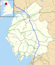
Birk Fell Hawse Mine is a Site of Special Scientific Interest (SSSI)[1][2] within the Lake District National Park in Cumbria, England. It is located on the Tilberthwaite Fells, near Wetherlam mountain, close to Little Langdale. This protected area has been designated because of the geology of the area.
Details
[edit]A copper vein from the Devonian period is found in this protected area. This site gives an exceptional example of mineralisation of a copper vein. The minerals chalcopyrite and bornite are found within this protected area.[1]
Land ownership
[edit]All of the land within Birk Fell Hawse Mine SSSI is owned by the National Trust.[3]
References
[edit]- ^ a b "SSSI detail". designatedsites.naturalengland.org.uk. Retrieved 2024-11-29.
- ^ "Protected Planet | Birk Fell Hawse Mine". Protected Planet. Retrieved 2024-11-29.
- ^ "Mapping the habitats of England's ten largest institutional landowners". Who owns England?. 2020-10-06. Retrieved 2024-11-29.

