Bilohrudove
Bilohrudove
Білогрудове | |
|---|---|
 A water-rescue station on Bilohrudyi Island | |
| Coordinates: 46°33′00″N 32°31′23″E / 46.550°N 32.523°E | |
| Country | |
| Oblast | Kherson Oblast |
| Raion | Skadovsk Raion |
| Hromada | Hola Prystan urban hromada |
| Founded | 1910[citation needed] |
| Population (2001) | |
• Total | 275 |
| Time zone | UTC+2 |
| • Summer (DST) | UTC+3 (EEST) |
| Postal code | 75604 |
| Area code | +380 5539 |
 | |
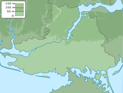
Bilohrudove (Ukrainian: Білогрудове) is a village (selo) in Skadovsk Raion, Kherson Oblast, Ukraine. It belongs to the Hola Prystan urban hromada, one of the hromadas of Ukraine.[1] The village is located 5 km. south of Kherson City on Bilohrudyi Island (Ukrainian: Білогрудий острів), one of the islands of the Dnieper delta.
History
[edit]Bilohrudove was occupied by Russia at the beginning of its invasion of Ukraine in late February 2022.[2]
The village was completely flooded when the Kakhovka Dam was destroyed on 6 June 2023.[3]
Bilohrudyi Island (including Bilohrudove) was reportedly liberated by Ukrainian forces in late June 2023.[4] On November 11 heavy fighting was reported to be ongoing on the island as the battle for control of the Dnipro continued.[5]
Demographics
[edit]According to the 1989 Soviet census, the population of Bilohrudove was 273, of which 131 were men and 142 were women.[6]
According to the 2001 Ukrainian census, the village had a population of 275. 92.49% of residents were native Ukrainian speakers, 7.17% were native Russian speakers, and the remaining 0.34% were native Belarusian speakers.[6]
References
[edit]- ^ "Білогрудове - Херсонська область". decentralization.gov.ua. Retrieved 2023-06-08.
- ^ "Interactive Map: Russia's Invasion of Ukraine". ArcGIS StoryMaps. 2023-06-08. Retrieved 2023-06-08.
- ^ "В зону затопления поврежденной Каховской ГЭС попали прибрежные зоны 14 населенных пунктов". Interfax.ru (in Russian). 2023-06-06. Retrieved 2023-06-08.
- ^ "Russian Offensive Campaign Assessment, June 26, 2023". Institute for the Study of War. June 26, 2023. Retrieved 2023-10-21.
- ^ https://www.understandingwar.org/backgrounder/russian-offensive-campaign-assessment-november-11-2023
- ^ a b "Банк даних". db.ukrcensus.gov.ua. Retrieved 2023-06-08.


