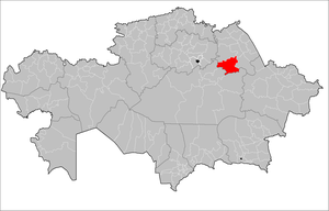
Bayanaul District
Appearance
Bayanaul | |
|---|---|
District | |
| Баянауыл ауданы | |
 | |
| Country | |
| Region | Pavlodar Region |
| Administrative center | Bayanaul |
| Founded | 1938 |
| Government | |
| • Akim | Ardak Kontaev[1] |
| Area | |
• Total | 7,100 sq mi (18,500 km2) |
| Population (2013)[2] | |
• Total | 27,899 |
| Time zone | UTC+6 (East) |
Bayanaul (Kazakh: Баянауыл ауданы, Baianauyl audany) is a district of Pavlodar Region in northern Kazakhstan. The administrative center of the district is the aul of Bayanaul.[3] Population: 27,899 (2013 estimate);[2] 28,296 (2009 Census results);[4] 32,985 (1999 Census results).[4]
Geography
[edit]Bayanaul District lies in the Kazakh Uplands. 1,022 meters (3,353 ft) high mount Akbet in the Bayanaul Range is the highest point in the district and Tuzkol is the largest lake.[5][6]
References
[edit]- ^ "Назначен аким Баянаульского района Павлодарской области". www.inform.kz (in Russian). 2023-01-16.
- ^ a b "Население Республики Казахстан" (in Russian). Департамент социальной и демографической статистики. Retrieved 27 December 2013.
- ^ "www.geonames.de Subdivisions of Kazakhstan in local languages". Archived from the original on 2016-03-03. Retrieved 2008-04-25.
- ^ a b "Население Республики Казахстан" [Population of the Republic of Kazakhstan] (in Russian). Департамент социальной и демографической статистики. Retrieved 8 December 2013.
- ^ "M-43 Topographic Chart (in Russian)". Retrieved 13 October 2022.
- ^ Google Earth
50°50′24″N 75°40′12″E / 50.84000°N 75.67000°E

